ARGO Home
Open menu
Stories
Themes
People
Partner Collections
About ARGO
Search
Empires and Nations:
British Empire
British Empire
French Empire
Wabanaki
United States
Spanish Empire
Dutch Empire
Danish Empire
Ohio Nations
Haudenosaunee (Iroquois) Confederacy
Cherokee Nation
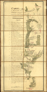
Carte de l'affaire de Montmouth
Library of Congress Collection
See map
Battle of Brandywine, 11 Septr. 1777
Library of Congress Collection
See map
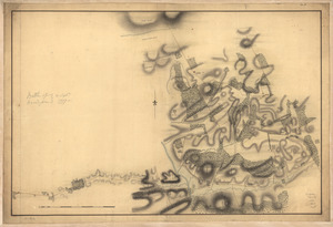
A Plan of the Battle of Bunker Hill
Library of Congress Collection
See map
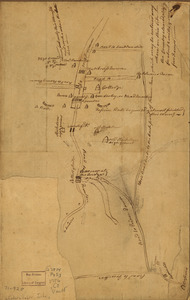
Plan of Princeton, Dec. 31, 1776
Library of Congress Collection
See map
Map of British outposts between Burlington and New Bridge, New Jersey, December 1776
Library of Congress Collection
See map
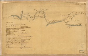
A Plan of the entrance of Chesapeak [sic] Bay, with James and York Rivers
Library of Congress Collection
See map
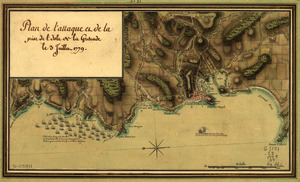
Plan de l'attaque et de la prise de l'isle de la Grenade le 3 juillet 1779
Library of Congress Collection
See map
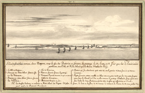
L'escadre françoise entrant dans Newport sous le feu des batteries et forcant le passage le 8 Aoust 1778
Library of Congress Collection
See map
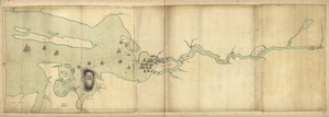
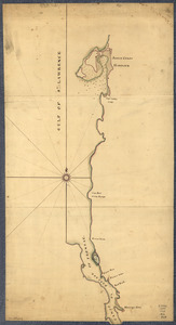
Northern part of the Gut of Canso
Library of Congress Collection
See map
Penobscot River and Bay, with the operations of the English fleet, under Sir George Collyer
Library of Congress Collection
See map
An accurate map of His Majesty's Province of New-Hampshire in New England & all the adjacent country northward to the River St. Lawrence, & eastward to Penobscot Bay
Library of Congress Collection
See map
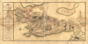
Plan de Rhodes-Island, et position de l'armée françoise a Newport
Library of Congress Collection
See map
Showing
229
to
240
of
439
results
Previous
Next
![A Plan of the entrance of Chesapeak [sic] Bay, with James and York Rivers](https://bpldcassets.blob.core.windows.net/derivatives/images/commonwealth:q524nf233/image_thumbnail_300.jpg)