ARGO Home
Open menu
Stories
Themes
People
Partner Collections
About ARGO
Search
Empires and Nations:
United States
British Empire
French Empire
Wabanaki
United States
Spanish Empire
Dutch Empire
Danish Empire
Ohio Nations
Haudenosaunee (Iroquois) Confederacy
Cherokee Nation
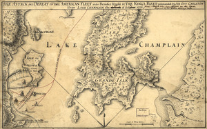
The Attack and defeat of the American fleet under Benedict Arnold
Library of Congress Collection
See map
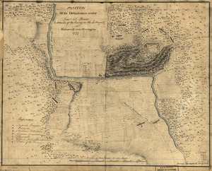
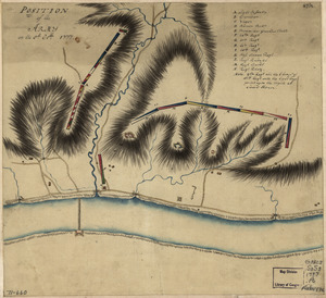
Position of the detachment under Lieut't Col. Baum & attacks of the enemy on the 16th August at Walmscock near Benington, 1777
Library of Congress Collection
See map
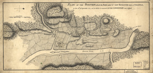
Plan of the position which the army under Lt. Genl. Burgoyne took at Saratoga
Library of Congress Collection
See map
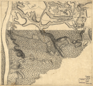
Position of the army on the 8th Octbr. 1777
Library of Congress Collection
See map
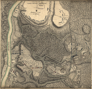
Plan of the encampment and position of the army under His Excelly. Lt. General Burgoyne
Library of Congress Collection
See map
Plan of the encampment and position of the army under His Excelly. Lt. General Burgoyne
Library of Congress Collection
See map
A plan of the Forts Montgomery & Clinton
Library of Congress Collection
See map
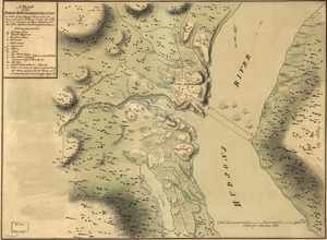
Map of Stony and Verplanck Points on the Hudson River as fortified by Sir Henry Clinton June 1779
Library of Congress Collection
See map
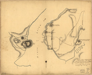
Sketch of Stoney & Verplank's Points upon the North River
Library of Congress Collection
See map
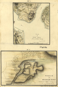
Plan of Perth Amboy from an actual survey. Sketch of Bonham Town
Library of Congress Collection
See map
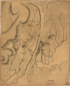
Plan of the country at and in the vicinity of Forts Lee and Independency, showing the position of the British Army
Library of Congress Collection
See map
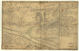
Sketch of the engagement at Trenton
Library of Congress Collection
See map
Showing
133
to
144
of
360
results
Previous
Next