ARGO Home
Open menu
Stories
Themes
People
Partner Collections
About ARGO
Search
Features:
Manuscript
Animal
Cartouche
Printed
Hand Coloring
Manuscript
Surveys
Atlas
Non-Map
Views
Marginalia
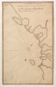
A Plan of George's Bay & Islands Call'd by the French I. du quinto
British Library Collection
See map
Plan of the Battery on the South Shore Erected against Fort Levy on the 21. of August 1760
British Library Collection
See map
Carte Nouvellement Releve de La presantation a Frontenac
British Library Collection
See map
[Map showing the location of Fort de la Presentation]
British Library Collection
See map
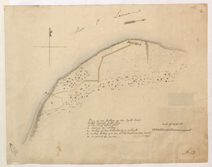
[Sketch map of an unidentified fort]
British Library Collection
See map
[Sketch map of the St Lawrence River at River Toniata]
British Library Collection
See map
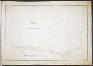
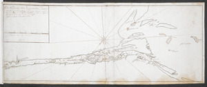
[Sketch map of the St Lawrence River from the Fort de la Présentation to Lake Ontario]
British Library Collection
See map
PLAN of the COMMUNICATION from TOWNSHIP No 8 to CATARAQUI as Surveyed by M.r Louis Kott Dep.t Prov.l Surv
British Library Collection
See map
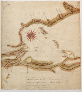
Nouveau plan du Lac ontario depuis Le fort frontenac jusquà Chouayguin, avec les isles Et Bancs qui y Sont
British Library Collection
See map
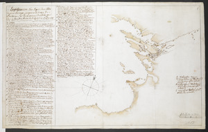
Explication d'un Esquis des Côtes depuis Oswego jusques a la Baye de Frontenac, et les environs des Isle qui Sont en l'embouchure de la Riviere St Laurent N.B. toutes ses observations demandent une plus exactes connoisances
British Library Collection
See map
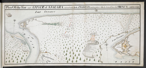
Plan Of the Fort and ATTACK of NIAGARA, and road leading To the ENGLISH Landing place, Also the Action Where the FRENCH were DEFEATED
British Library Collection
See map
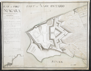
PLAN of FORT NIAGARA With its Buildings & outworks
British Library Collection
See map
Showing
121
to
132
of
946
results
Previous
Next
![[Sketch map of the St Lawrence River from the Fort de la Présentation to Lake Ontario]](https://bpldcassets.blob.core.windows.net/derivatives/images/commonwealth:hx11z1051/image_thumbnail_300.jpg)
![[Map showing the location of Fort de la Presentation]](https://bpldcassets.blob.core.windows.net/derivatives/images/commonwealth:hx11z0993/image_thumbnail_300.jpg)
![[Sketch map of an unidentified fort]](https://bpldcassets.blob.core.windows.net/derivatives/images/commonwealth:hx11z101x/image_thumbnail_300.jpg)
![[Sketch map of the St Lawrence River at River Toniata]](https://bpldcassets.blob.core.windows.net/derivatives/images/commonwealth:hx11z103g/image_thumbnail_300.jpg)