ARGO Home
Open menu
Stories
Themes
People
Partner Collections
About ARGO
Search
Features:
Manuscript
Animal
Cartouche
Printed
Hand Coloring
Manuscript
Surveys
Atlas
Non-Map
Views
Marginalia
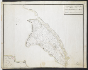
[Map showing rivers and forts in North America]
British Library Collection
See map
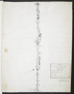
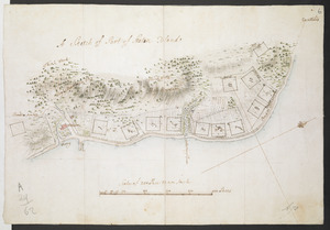
A Sketch of Part of Staten Island
British Library Collection
See map
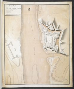
PLAN FORT EDWARD
British Library Collection
See map
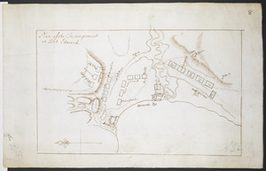
Plan of the Incampement at Fort Edward
British Library Collection
See map
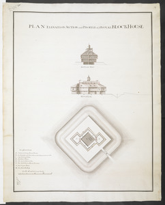
PLAN ELEVATION SECTION and PROFILE of ye ROYAL BLOCKHOUSE
British Library Collection
See map
[Map showing Fort William Henry, Fort Carillon, Fort St Frederic, and the upper reaches of the Connecticut River]
British Library Collection
See map
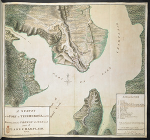
A SURVEY of the FORT at TIENDEROGA and its Environs, with the FRENCH LINES and part of LAKE CHAMPLAIN 1759
British Library Collection
See map
[PLAN de Carillon]
British Library Collection
See map
[Map of Fort Carillon]
British Library Collection
See map
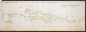
Carte du Lac Champlain depuis le Fort de Chambly Jusques au desus du Fort S.t Frederic, dans la Nouvelle France
British Library Collection
See map
Sketch of the Isthmus to the NE of Crown Point
British Library Collection
See map
Draught of a Scout over the Mountains West-ward of Lake Champlain
British Library Collection
See map
Showing
157
to
168
of
946
results
Previous
Next
![[Map showing Fort William Henry, Fort Carillon, Fort St Frederic, and the upper reaches of the Connecticut River]](https://bpldcassets.blob.core.windows.net/derivatives/images/commonwealth:hx11z1735/image_thumbnail_300.jpg)
![[Map showing rivers and forts in North America]](https://bpldcassets.blob.core.windows.net/derivatives/images/commonwealth:hx11z163x/image_thumbnail_300.jpg)
![[PLAN de Carillon]](https://bpldcassets.blob.core.windows.net/derivatives/images/commonwealth:hx11z1778/image_thumbnail_300.jpg)
![[Map of Fort Carillon]](https://bpldcassets.blob.core.windows.net/derivatives/images/commonwealth:hx11z179t/image_thumbnail_300.jpg)