ARGO Home
Open menu
Stories
Themes
People
Partner Collections
About ARGO
Search
Features:
Manuscript
Animal
Cartouche
Printed
Hand Coloring
Manuscript
Surveys
Atlas
Non-Map
Views
Marginalia
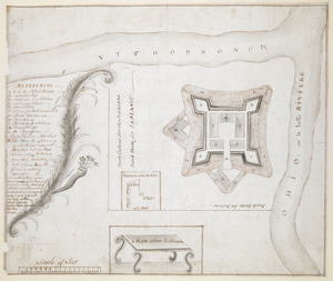
A PLAN of FORT De Quesne
British Library Collection
See map
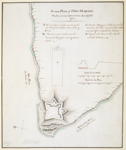
Rough PLAN of FORT DUQUESNE such as it was before it was demolish'd 1758
British Library Collection
See map
A plan of the New Fort at Pittsburgh Novr 1759
British Library Collection
See map
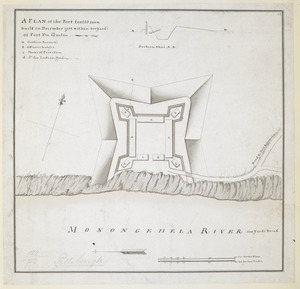
A PLAN of the Fort for 220 men built in December 1758 within 400 Yard's of Fort du Quesne
British Library Collection
See map
PLAN OF SANDY HOOK 28. Miles from New York
British Library Collection
See map
PLAN OF THE PENINSULA OF CHESOPEAK BAY
British Library Collection
See map
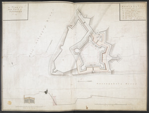
A PLAN of FORT CUMBERLAND on Will's CREEK & POTOMACK River with a View of the Store Houses belonging to the OHIO COMPANY on the Other Side of the River
British Library Collection
See map
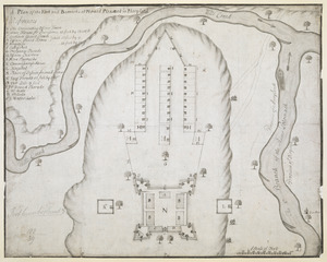
A Plan of the Fort and Barracks at Mount Pleasant in Maryland
British Library Collection
See map
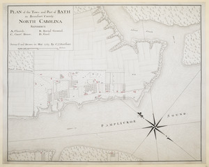
PLAN of the Town and Port of BATH in Beaufort County NORTH CAROLINA
British Library Collection
See map
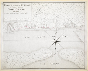
PLAN of the Town & Port of BEAUFORT in Carteret County NORTH CAROLINA
British Library Collection
See map
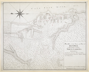
PLAN of the Town and Port of BRUNSWICK in Brunswick County. NORTH CAROLINA
British Library Collection
See map
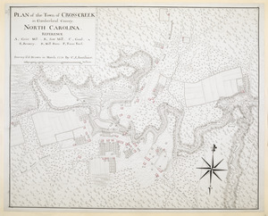
PLAN of the Town of CROSS CREEK in Cumberland County. NORTH CAROLINA
British Library Collection
See map
Showing
277
to
288
of
946
results
Previous
Next