ARGO Home
Open menu
Stories
Themes
People
Partner Collections
About ARGO
Search
Features:
Manuscript
Animal
Cartouche
Printed
Hand Coloring
Manuscript
Surveys
Atlas
Non-Map
Views
Marginalia
PLAN of part of FORT GEORGE with the BARRACKS &c Erected in the Year 1759
British Library Collection
See map
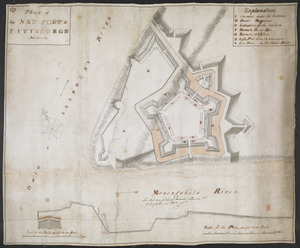
PLAN of the NEW FORT at PITTSBURGH November 1759
British Library Collection
See map
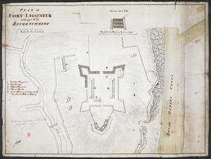
PLAN of FORT LIGONIER with part of the RETRENCHMENT
British Library Collection
See map
[Map showing operations against Philadelphia by the British in November 1777]
British Library Collection
See map
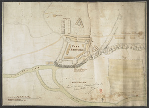
FORT BEDFORD
British Library Collection
See map
[Account of the action at Fort Niagara]
British Library Collection
See map
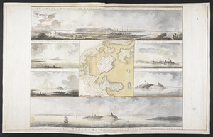
VIEW of BOSTON the Capital of NEW ENGLAND from Col. HATCH's House on the Road to DORCHESTER = VIEW FROM DORCHESTER NECK = VIEW of CASTLE WILLIAM at Station C = VIEW FROM CHARLESTOWN = VIEW OF CASTLE WILLIAM at Station D = VIEW of CASTLE WILLIAM
British Library Collection
See map
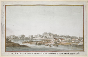
VIEW of HARLAEM from MORISANIA in the PROVINCE of NEW YORK Septem.r 1765
British Library Collection
See map
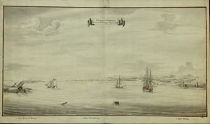
A Prospect of LOUISBOURG taken from ye NE Harbour
British Library Collection
See map
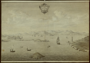
A VIEW of the TOWN & HARBOUR of LOUISBOURG
British Library Collection
See map
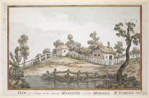
VIEW of a Cottage on the Island MASSACRE near the MOBILLE W. FLORIDA. Oct.r 1764
British Library Collection
See map
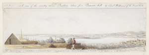
A View of the country round Boston taken from Beacon hill
British Library Collection
See map
Showing
25
to
36
of
946
results
Previous
Next

![[Map showing operations against Philadelphia by the British in November 1777]](https://bpldcassets.blob.core.windows.net/derivatives/images/commonwealth:6108vv61k/image_thumbnail_300.jpg)
![[Account of the action at Fort Niagara]](https://bpldcassets.blob.core.windows.net/derivatives/images/commonwealth:6108vv66z/image_thumbnail_300.jpg)