ARGO Home
Open menu
Stories
Themes
People
Partner Collections
About ARGO
Search
Features:
Manuscript
Animal
Cartouche
Printed
Hand Coloring
Manuscript
Surveys
Atlas
Non-Map
Views
Marginalia
Plano del puerto de la Havana, situado en la parte del N. de la ysla de Cuba en la lattd. de 23⁰10ʹ y en longd. astronómica de 293⁰47ʹ, meridiano de Tenerife ... el año de 1783 por Dn. Josef de Sn. Martin, the. de Navio de la Rl. Armada
Library of Congress Collection
See map
Plano de la Baía de Guantánamo, en la ysla de Cuva, cuya boca se alla en latitud N. 20 gs. y en la longitd. de Thenerife 301 gs. 27 ms
Library of Congress Collection
See map
A Sketch of the harbour of St. Iago de Cuba
Library of Congress Collection
See map
Carte générale de la partie française de l'isle de St. Domingue
Library of Congress Collection
See map
A Sketch of the harbour of Port Francoise on the Island of Hispaniola
Library of Congress Collection
See map
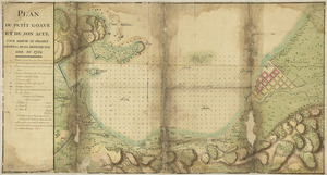
Plan du Petit Goâve et de son acul pour servir au projet général de sa défense par mer en 1752
Library of Congress Collection
See map
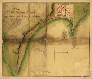
Plan de la ville du Trou Jéremie
Library of Congress Collection
See map
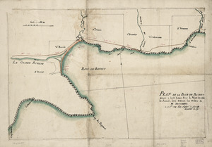
Plan de la Baye de Baynet
Library of Congress Collection
See map
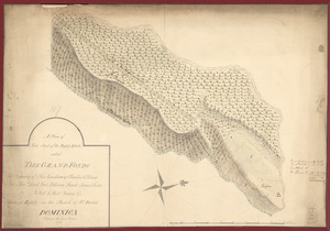
A plan of that part of the Rosalij Estate called the Grand Fonds
Library of Congress Collection
See map
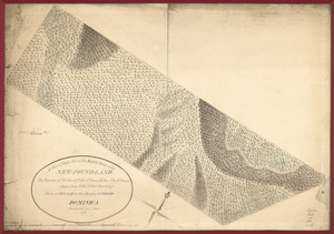
A plan of that part of the Rosalij Estate call'd New-Found-Land
Library of Congress Collection
See map
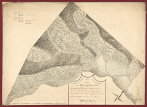
A plan of that part of the Rosalij Estate called Rosalij Valley
Library of Congress Collection
See map
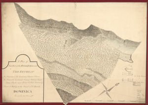
A plan of that part of the Rosalij Estate call'd the Retreat
Library of Congress Collection
See map
Showing
565
to
576
of
946
results
Previous
Next