ARGO Home
Open menu
Stories
Themes
People
Partner Collections
About ARGO
Search
Features:
Manuscript
Animal
Cartouche
Printed
Hand Coloring
Manuscript
Surveys
Atlas
Non-Map
Views
Marginalia
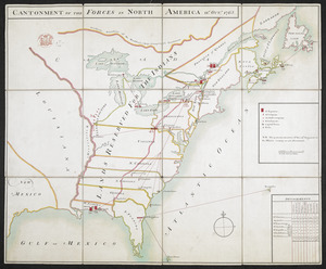
CANTONMENT OF THE FORCES IN NORTH AMERICA 11.th OCT.R 1765
British Library Collection
See map
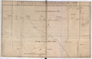
A Map of the Country Adjacent to the North Boundary Line of of the Colony of Rhode Island as the same was Run by Commissioners appointed for that Purpose by the General Asssembly of the Said Colony in the year 1750
British Library Collection
See map
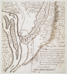
Plan of Fort Edward
British Library Collection
See map
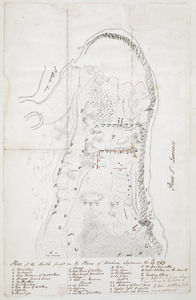
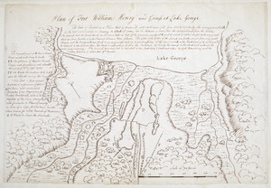
Plan of Fort William Henry and Camp at Lake George
British Library Collection
See map
Plan of the Battle fought on the Plains of Abraham, September the 13th 1759
British Library Collection
See map
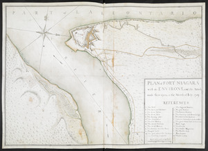
PLAN of FORT NIAGARA with its ENVIRONS, and the Attack made there-upon, in the Month of Iuly 1759
British Library Collection
See map
[Map showing the attack of the French upon York in Virginia, June 1782]
British Library Collection
See map
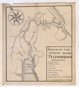
SKETCH OF THE COUNTRY ROUND TYCONDEROGA
British Library Collection
See map
[Lake Ontario]
British Library Collection
See map
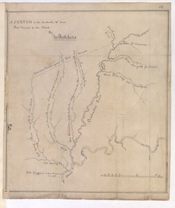
A SKETCH of the Ouabache &c from Post Vincent to the Ohio
British Library Collection
See map
[Map of Quebec and environs showing the position of the English and French troops]
British Library Collection
See map
[Map of Fort Detroit and environs]
British Library Collection
See map
Showing
61
to
72
of
946
results
Previous
Next
![[Map showing the attack of the French upon York in Virginia, June 1782]](https://bpldcassets.blob.core.windows.net/derivatives/images/commonwealth:hx11xz51j/image_thumbnail_300.jpg)
![[Map of Quebec and environs showing the position of the English and French troops]](https://bpldcassets.blob.core.windows.net/derivatives/images/commonwealth:hx11xz61s/image_thumbnail_300.jpg)
![[Lake Ontario]](https://bpldcassets.blob.core.windows.net/derivatives/images/commonwealth:hx11xz576/image_thumbnail_300.jpg)
![[Map of Fort Detroit and environs]](https://bpldcassets.blob.core.windows.net/derivatives/images/commonwealth:hx11xz63b/image_thumbnail_300.jpg)