ARGO Home
Open menu
Stories
Themes
People
Partner Collections
About ARGO
Search
Languages:
English
English
French
German
Latin
Spanish
Appearance of the land from the White Islands to St. Marys River taken two leagues off shore
Norman B. Leventhal Map & Education Center Collection
See map
Sandwich Bay ... low water
Norman B. Leventhal Map & Education Center Collection
See map
[Torbay]
Norman B. Leventhal Map & Education Center Collection
See map
White Haven
Norman B. Leventhal Map & Education Center Collection
See map
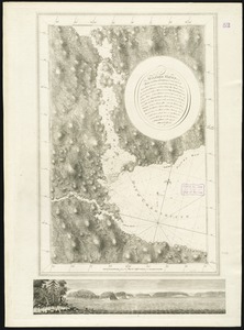
[St. Peter's Bay, on the south shore of Cape Breton Island]
Norman B. Leventhal Map & Education Center Collection
See map
Crow Harbour
Norman B. Leventhal Map & Education Center Collection
See map
Milford Haven
Norman B. Leventhal Map & Education Center Collection
See map
Conway Harbour
Norman B. Leventhal Map & Education Center Collection
See map
[Lennox Passage region]
Norman B. Leventhal Map & Education Center Collection
See map
The Gut of Canso
Norman B. Leventhal Map & Education Center Collection
See map
[North east coast of Nova Scotia and Northumberland Strait]
Norman B. Leventhal Map & Education Center Collection
See map
[North east coast of Nova Scotia and Northumberland Strait]
Norman B. Leventhal Map & Education Center Collection
See map
Showing
1129
to
1140
of
1647
results
Previous
Next

![[St. Peter's Bay, on the south shore of Cape Breton Island]](https://bpldcassets.blob.core.windows.net/derivatives/images/commonwealth:ws859h094/image_thumbnail_300.jpg)
![[North east coast of Nova Scotia and Northumberland Strait]](https://bpldcassets.blob.core.windows.net/derivatives/images/commonwealth:ws859h21d/image_thumbnail_300.jpg)
![[North east coast of Nova Scotia and Northumberland Strait]](https://bpldcassets.blob.core.windows.net/derivatives/images/commonwealth:ws859h23z/image_thumbnail_300.jpg)

![[Torbay]](https://bpldcassets.blob.core.windows.net/derivatives/images/commonwealth:ws859h01x/image_thumbnail_300.jpg)


![[Lennox Passage region]](https://bpldcassets.blob.core.windows.net/derivatives/images/commonwealth:ws859h17t/image_thumbnail_300.jpg)
