ARGO Home
Open menu
Stories
Themes
People
Partner Collections
About ARGO
Search
Subject:
Houses and Property
Borders
Indigenous Peoples
Roads and Routes
Houses and Property
Military
PLAN DE L'INTENDANCE DE QUE'BEC
British Library Collection
See map
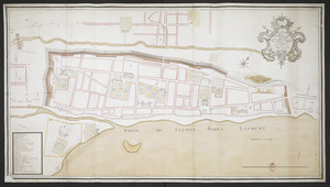
PLAN DE LA VILLE DE MONT REAL DEDIER A SON EXCELLENCE M.R LE GENERAL AMHERST COMMANDANT EN CHEF LES FORCES DE SA MAJESTE BRIITANNIQUE DANS LAMERIQUE SEPTENTRIONNAL
British Library Collection
See map
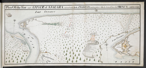
Plan Of the Fort and ATTACK of NIAGARA, and road leading To the ENGLISH Landing place, Also the Action Where the FRENCH were DEFEATED
British Library Collection
See map
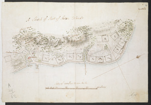
Plan of the Settlement on the Bay of Quinte
British Library Collection
See map
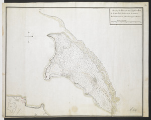
A Sketch of Part of Staten Island
British Library Collection
See map
[Map showing Fort William Henry, Fort Carillon, Fort St Frederic, and the upper reaches of the Connecticut River]
British Library Collection
See map
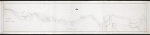
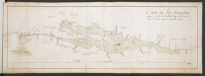
Carte du Lac Champlain depuis le Fort de Chambly Jusques au desus du Fort S.t Frederic, dans la Nouvelle France
British Library Collection
See map
Sketch of the Isthmus to the NE of Crown Point
British Library Collection
See map
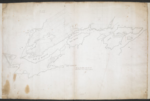
PART OF HUDSON'S RIVER
British Library Collection
See map
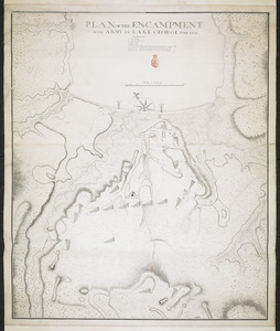
PLAN OF THE ENCAMPMENT OF THE ARMY AT LAKE GEORGE JUNE 1759
British Library Collection
See map
[Map showing military locations from Fort Cumberland on the River Potomac to Fort Presqu'Isle on Lake Erie]
British Library Collection
See map
[Map showing military locations from Fort Cumberland on the River Potomac to Fort Presqu'Isle on Lake Erie]
British Library Collection
See map
Showing
241
to
252
of
967
results
Previous
Next
![[Map showing Fort William Henry, Fort Carillon, Fort St Frederic, and the upper reaches of the Connecticut River]](https://bpldcassets.blob.core.windows.net/derivatives/images/commonwealth:hx11z1735/image_thumbnail_300.jpg)
![[Map showing military locations from Fort Cumberland on the River Potomac to Fort Presqu'Isle on Lake Erie]](https://bpldcassets.blob.core.windows.net/derivatives/images/commonwealth:hx11z2324/image_thumbnail_300.jpg)
![[Map showing military locations from Fort Cumberland on the River Potomac to Fort Presqu'Isle on Lake Erie]](https://bpldcassets.blob.core.windows.net/derivatives/images/commonwealth:hx11z2367/image_thumbnail_300.jpg)