ARGO Home
Open menu
Stories
Themes
People
Partner Collections
About ARGO
Search
Subject:
Houses and Property
Borders
Indigenous Peoples
Roads and Routes
Houses and Property
Military
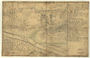
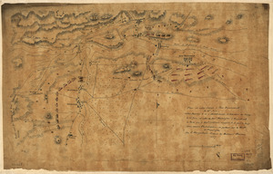
Sketch of the engagement at Trenton
Library of Congress Collection
See map
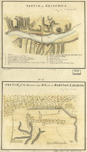
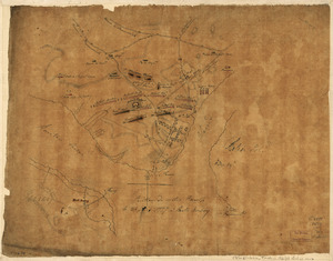
Sketch of Brunswick
Library of Congress Collection
See map
Plan de notre camp à New Brunswick le 12e. juin
Library of Congress Collection
See map
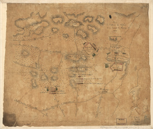
Position de notre camp le 24 juin 1777 à Perth Amboy
Library of Congress Collection
See map
Plan de l'affaire de Westfield & du camp de Raway
Library of Congress Collection
See map
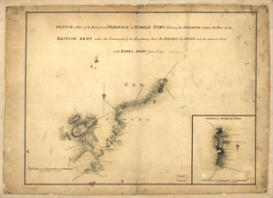
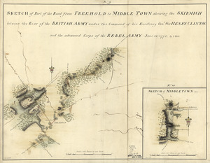
Sketch of part of the road from Freehold to Middle Town
Library of Congress Collection
See map
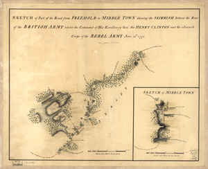
Sketch of part of the road from Freehold to Middle Town
Library of Congress Collection
See map
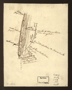
Sketch of part of the road from Freehold to Middle Town
Library of Congress Collection
See map
Map showing roads to Morristown
Library of Congress Collection
See map
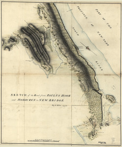
Sketch of the road from Paulus Hook and Hobocken to New Bridge
Library of Congress Collection
See map
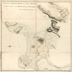
A plan of Paulus Hook with the road to Bergen and parts adjacent in the province of New Jersey
Library of Congress Collection
See map
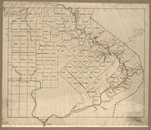
The Part of Pennsylvania that lies between the forks of the Susquehannah, divided into townships
Library of Congress Collection
See map
Showing
421
to
432
of
967
results
Previous
Next