ARGO Home
Open menu
Stories
Themes
People
Partner Collections
About ARGO
Search
Subject:
Houses and Property
Borders
Indigenous Peoples
Roads and Routes
Houses and Property
Military
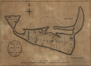
Map of the island of Nantucket
Library of Congress Collection
See map
Grundriss von der Stadt Boston und ihren Gegenden
Library of Congress Collection
See map
Map of the environs of Roxbury showing roads to Jamaica, Cambridge, Dorchester, Milton, etc
Library of Congress Collection
See map
Boston, S. West part
Library of Congress Collection
See map
A draught of the towns of Boston and Charles Town and the circumjacent country
Library of Congress Collection
See map
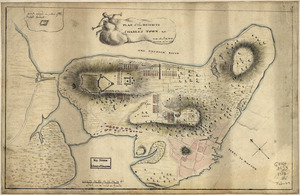
Plan of the peninsula of Charles Town shewing the three posts that His Majesty's troops have kept and fortified with buildings therein for guard rooms
Library of Congress Collection
See map
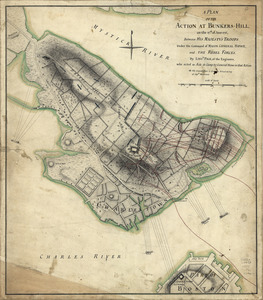
A plan of the action at Bunkers-Hill, on the 17th. of June, 1775
Library of Congress Collection
See map
[Rough draught of Boston and harbour]
Library of Congress Collection
See map
[Plan of the Neck and environs]
Library of Congress Collection
See map
Plan of Boston & vicinity
Library of Congress Collection
See map
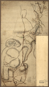
[Rough draft of Charlestown, in water colour]
Library of Congress Collection
See map
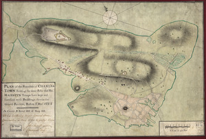
Plan of the heights of Charles Town, &c
Library of Congress Collection
See map
Showing
733
to
744
of
967
results
Previous
Next


![[Rough draught of Boston and harbour]](https://bpldcassets.blob.core.windows.net/derivatives/images/commonwealth:z603vj39m/image_thumbnail_300.jpg)
![[Plan of the Neck and environs]](https://bpldcassets.blob.core.windows.net/derivatives/images/commonwealth:z603vj436/image_thumbnail_300.jpg)

![[Rough draft of Charlestown, in water colour]](https://bpldcassets.blob.core.windows.net/derivatives/images/commonwealth:z603vj49v/image_thumbnail_300.jpg)