ARGO Home
Open menu
Stories
Themes
People
Partner Collections
About ARGO
Search
Subject:
Indigenous Peoples
Borders
Indigenous Peoples
Roads and Routes
Houses and Property
Military
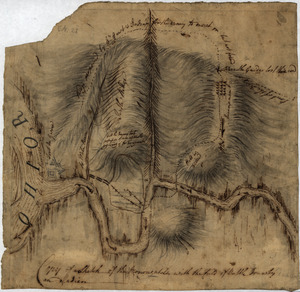
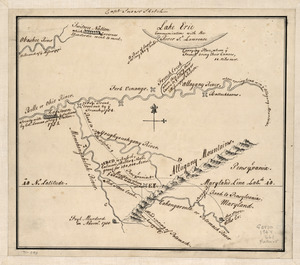
Captain Snow's sketch
Library of Congress Collection
See map
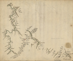
Mr. Armstrong's rough draft of the country to the west of Susquehanna
Library of Congress Collection
See map
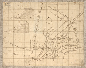
Map of a route through south west Pennsylvania from Fort Loudon, Franklin Co. to Fort Pitt, Pittsburgh
Library of Congress Collection
See map
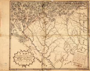
A Plan of that part of the boundary between the states of North and South Carolina
Library of Congress Collection
See map
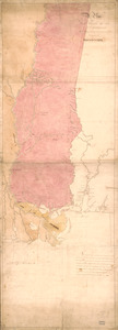
A Map of the lands ceded by the Cherokee Indians to the State of South-Carolina
Library of Congress Collection
See map
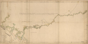
A map of Savannah River beginning at Stone-Bluff, or Nexttobethell, which continueth to the sea
Library of Congress Collection
See map
A Plan of West Florida, the Isle of Orleans, and some parts of the Spanish dominions to the westward of the Mississipi
Library of Congress Collection
See map
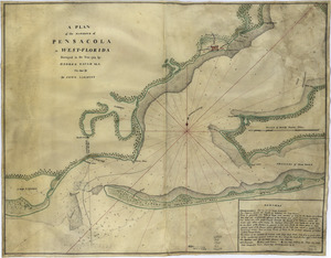
A plan of the harbour of Pensacola in West-Florida
Library of Congress Collection
See map
Plan of Carillon ou [sic] Ticonderoga
Library of Congress Collection
See map
Copy of a sketch of the Monongahela, with the field of battle
Library of Congress Collection
See map
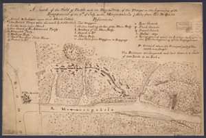
A sketch of the field of battle with the disposition of the troops in the beginning of the engagement of the 9th of July on the Monongahela 7 miles from Fort Du Quesne
Library of Congress Collection
See map
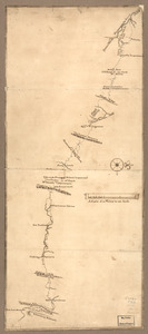
Braddock's route, 1755, Fort Cumberland to Fort Pitt
Library of Congress Collection
See map
Showing
229
to
240
of
598
results
Previous
Next

![Plan of Carillon ou [sic] Ticonderoga](https://bpldcassets.blob.core.windows.net/derivatives/images/commonwealth:q524nk513/image_thumbnail_300.jpg)