ARGO Home
Open menu
Stories
Themes
People
Partner Collections
About ARGO
Search
Subject:
Military
Borders
Indigenous Peoples
Roads and Routes
Houses and Property
Military
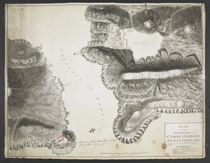
A Plan of the Road, Harbour and Town of Placentia in the Island of Newfoundland From an Actual Survey shewing the Situation of the Batteries that are Proposed for their Defence
British Library Collection
See map
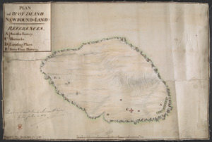
PLAN of BUOY ISLAND NEW FOUND-LAND
British Library Collection
See map
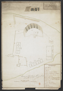
PLAN of FORT FREDERICK at NEWFOUND-LAND as it is now with the new Additions
British Library Collection
See map
[Map showing Saint John's Harbour with Fort William and Fort Townshend]
British Library Collection
See map
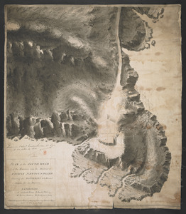
PLAN of the SOUTH HEAD of the Entrance into the Harbour of St IOHNS NEWFOUNDLAND Shewing the BATTERIES to be Erected theron for its Defence
British Library Collection
See map
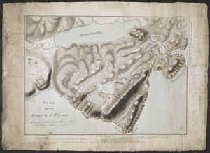
PART OF THE HARBOUR of ST IOHNS
British Library Collection
See map
PLAN OF THE ENTRANCE OF ST IOHN'S HARBOUR NEWFOUNDLAND Shewing the additional Work's erecting for its defence
British Library Collection
See map
[Entrance to the Harbour of S.t Johns Newfoundland]
British Library Collection
See map
[Six sectional drawings of the Harbour of Saint John, Newfoundland]
British Library Collection
See map
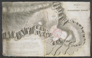
PLAN of PALLISSERS TOWER
British Library Collection
See map
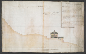
Section taken from the nearest Commanding Ground thro' the Center of the TOWER to High Water Mark
British Library Collection
See map
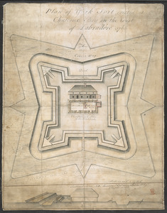
Plan of York Fort erected at Chateaux bay on the Coast of Labradore 1766
British Library Collection
See map
Showing
25
to
36
of
876
results
Previous
Next
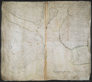
![[Map showing Saint John's Harbour with Fort William and Fort Townshend]](https://bpldcassets.blob.core.windows.net/derivatives/images/commonwealth:6108vv278/image_thumbnail_300.jpg)
![[Six sectional drawings of the Harbour of Saint John, Newfoundland]](https://bpldcassets.blob.core.windows.net/derivatives/images/commonwealth:6108vv37h/image_thumbnail_300.jpg)
![[Entrance to the Harbour of S.t Johns Newfoundland]](https://bpldcassets.blob.core.windows.net/derivatives/images/commonwealth:6108vv35z/image_thumbnail_300.jpg)