ARGO Home
Open menu
Stories
Themes
People
Partner Collections
About ARGO
Search
Subject:
Military
Borders
Indigenous Peoples
Roads and Routes
Houses and Property
Military
Nord de l'Ile de New-York
Library of Congress Collection
See map
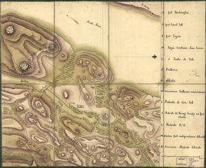
Reconnoissance de King's bridge
Library of Congress Collection
See map
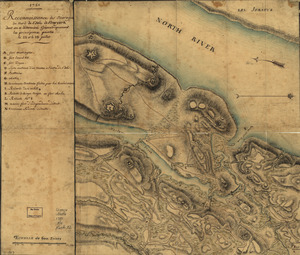
Reconnoissance des ouvrages du nord de l'Isle de Newyork dont on a déterminé géometriquement les principaux points le 22 et le 23 juillet
Library of Congress Collection
See map
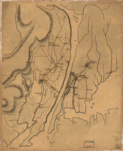
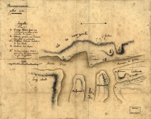
Reconnoissance, juillet 1781
Library of Congress Collection
See map
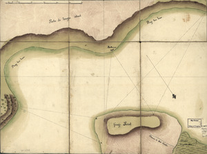
Frog's Point avec batteries de Partie de Longue Island
Library of Congress Collection
See map
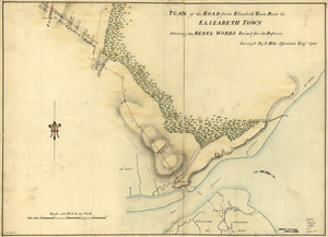
Plan of the road from Elizabeth Town Point to Elizabeth Town
Library of Congress Collection
See map
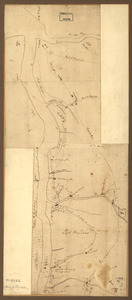
Amboy to Elizabethtown
Library of Congress Collection
See map
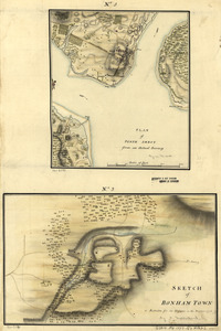
Plan of Perth Amboy from an actual survey. Sketch of Bonham Town
Library of Congress Collection
See map
Map of the environs of Camden, N.J
Library of Congress Collection
See map
Draft of roads in New Jersey
Library of Congress Collection
See map
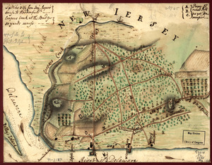
Plan of the country at and in the vicinity of Forts Lee and Independency, showing the position of the British Army
Library of Congress Collection
See map
Sketch of the engagement at Trenton
Library of Congress Collection
See map
Showing
457
to
468
of
876
results
Previous
Next