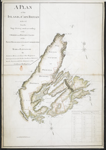
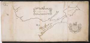
A PLAN of the ISLAND of CAPE BRITAIN reduced from the large Survey made according to the ORDERS and INSTRUCTIONS of the RIGHT HONORABLE the LORDS COMMISSIONERS for TRADE and PLANTATIONS
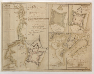
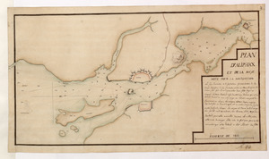
Sketch Of Part of S.t John's Harbour and River= Plan of Fort Frederick with the Necessary Alterations= Plan of the Ramainder of the French Fort= Plan of Fort Frederick built at the Entrance of S.t John's River since the 24.th Septemr 1758.= Plan Of the Situation of Fort Frederick
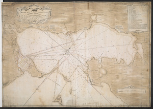
Plan of the Harbour of St John's in the Bay of Fundy= Plan & Section of the Fort as it is Near Finish'd= Plan & Section's of the Remains of the old French Fort
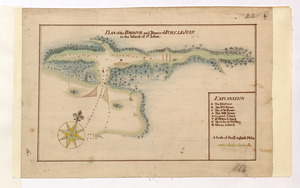

![[Map showing neck of land between 'Baye francaise' and 'Baye verte']](https://bpldcassets.blob.core.windows.net/derivatives/images/commonwealth:hx11z035j/image_thumbnail_300.jpg)

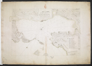
![[Plan de Louisburgh, et partie de la baye de Gabarus]](https://bpldcassets.blob.core.windows.net/derivatives/images/commonwealth:hx11z045s/image_thumbnail_300.jpg)