ARGO Home
Open menu
Stories
Themes
People
Partner Collections
About ARGO
Search
Subject:
Roads and Routes
Borders
Indigenous Peoples
Roads and Routes
Houses and Property
Military
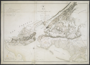
A MAP of NEW YORK, & STATEN ISLDS; And part of LONG ISLAND
British Library Collection
See map
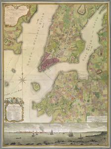
PLAN of the CITY of NEW YORK, in North America
British Library Collection
See map
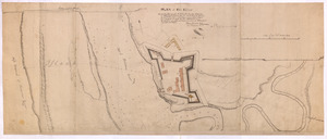
PLAN of Fort Edward
British Library Collection
See map
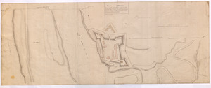
PLAN of Fort EDWARD
British Library Collection
See map
PLAN OF SANDY HOOK 28. Miles from New York
British Library Collection
See map
PLAN OF THE PENINSULA OF CHESOPEAK BAY
British Library Collection
See map
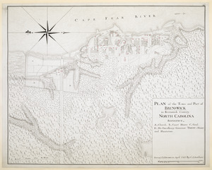
PLAN of the Town and Port of BRUNSWICK in Brunswick County. NORTH CAROLINA
British Library Collection
See map
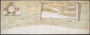
[Coast of South Carolina, Georgia and Florida from Charleston to St. Augustine]
British Library Collection
See map
[Coast of South Carolina, Georgia and Florida from Charleston to St. Augustine]
British Library Collection
See map
A Survey of the Coast from FORT WILLIAM near S.t Iuans River to Mosquito River
British Library Collection
See map
[Map of the coast of Florida from Fort William to Musketae River] [north sheet]
British Library Collection
See map
[Map of the coast of Florida from Fort William to Musketae River] [south sheet]
British Library Collection
See map
Showing
361
to
372
of
1113
results
Previous
Next
![[Coast of South Carolina, Georgia and Florida from Charleston to St. Augustine]](https://bpldcassets.blob.core.windows.net/derivatives/images/commonwealth:hx11z448f/image_thumbnail_300.jpg)
![[Coast of South Carolina, Georgia and Florida from Charleston to St. Augustine]](https://bpldcassets.blob.core.windows.net/derivatives/images/commonwealth:hx11z450g/image_thumbnail_300.jpg)
![[Map of the coast of Florida from Fort William to Musketae River] [north sheet]](https://bpldcassets.blob.core.windows.net/derivatives/images/commonwealth:hx11z4742/image_thumbnail_300.jpg)
![[Map of the coast of Florida from Fort William to Musketae River] [south sheet]](https://bpldcassets.blob.core.windows.net/derivatives/images/commonwealth:hx11z476m/image_thumbnail_300.jpg)