ARGO Home
Open menu
Stories
Themes
People
Partner Collections
About ARGO
Search
Subject:
Roads and Routes
Borders
Indigenous Peoples
Roads and Routes
Houses and Property
Military
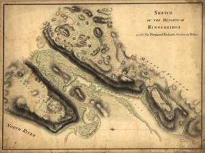
Sketch of the Heights of Kingsbridge, with the proposed redouts couloured yellow
Library of Congress Collection
See map
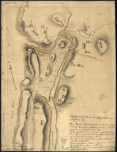
Disposition of British troops, with fortifications north of Fort Knipehausen, i.e. Fort Washington to Fort Independence
Library of Congress Collection
See map
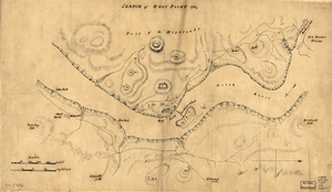
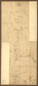
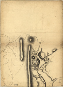
Skecth [sic] of the road from Kings Bridge to White Plains
Library of Congress Collection
See map
Part of a map of the Hudson Highlands showing Forts Clinton and Montgomery
Library of Congress Collection
See map
Sketch of West Point
Library of Congress Collection
See map
Nord de l'Ile de New-York
Library of Congress Collection
See map
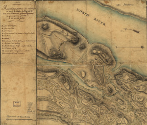
Reconnoissance de King's bridge
Library of Congress Collection
See map
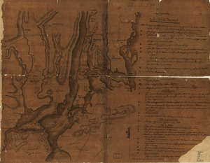
Plan de New-York et les environs
Library of Congress Collection
See map
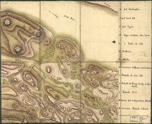
Reconnoissance des ouvrages du nord de l'Isle de Newyork dont on a déterminé géometriquement les principaux points le 22 et le 23 juillet
Library of Congress Collection
See map
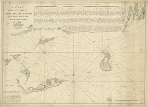
A plan of the east part of Long Island Sound
Library of Congress Collection
See map
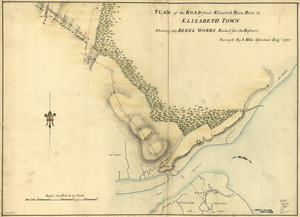
Plan of the road from Elizabeth Town Point to Elizabeth Town
Library of Congress Collection
See map
Amboy to Elizabethtown
Library of Congress Collection
See map
Showing
481
to
492
of
1113
results
Previous
Next
![Skecth [sic] of the road from Kings Bridge to White Plains](https://bpldcassets.blob.core.windows.net/derivatives/images/commonwealth:q524n8895/image_thumbnail_300.jpg)