ARGO Home
Open menu
Stories
Themes
People
Partner Collections
About ARGO
Search
Features:
Manuscript
Animal
Cartouche
Printed
Hand Coloring
Manuscript
Surveys
Atlas
Non-Map
Views
Marginalia
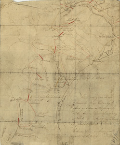
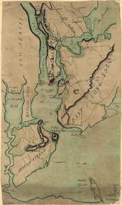
This is not given as an accurate map, but only to afford an idea of the progress of the army from the landing at Elk to the taking of possession of Philadelphia
Library of Congress Collection
See map
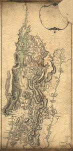
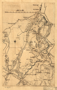
Lake Champlain and Lake George, and the country between the Hudson and the lakes on the west, and Connecticut River on the east
Library of Congress Collection
See map
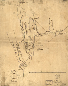
A draught of Lake George, and part of Hudson's River taken September 1756
Library of Congress Collection
See map
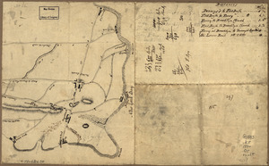
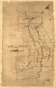
Map of the patent of Oriskany
Library of Congress Collection
See map
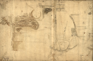
Map showing the Bowery Lane area of Manhattan
Library of Congress Collection
See map
Map of the roads from New Rochelle to Kingstreet, Westchester County
Library of Congress Collection
See map
Map of Orange and Rockland counties area of New York
Library of Congress Collection
See map
Old map of Brooklyn and greater part of King's County, Long Island
Library of Congress Collection
See map
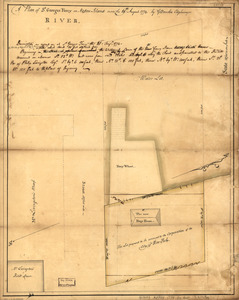
A plan of St. Georges Ferry on Nassau-Island made the 10th August 1774
Library of Congress Collection
See map
Country between North River and Croton River
Library of Congress Collection
See map
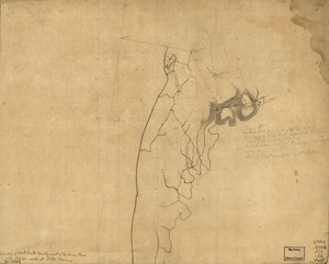
Westchester County coast, New Rochelle to Horseneck River: unfinished
Library of Congress Collection
See map
Plan of New York and Staten Islands with part of Long Island
Library of Congress Collection
See map
Showing
385
to
396
of
946
results
Previous
Next