ARGO Home
Open menu
Stories
Themes
People
Partner Collections
About ARGO
Search
Features:
Manuscript
Animal
Cartouche
Printed
Hand Coloring
Manuscript
Surveys
Atlas
Non-Map
Views
Marginalia
A Plan of the city of New York
Library of Congress Collection
See map
Ticonderoga as it was in 1759
Library of Congress Collection
See map
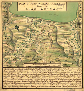
Plan of Fort William Henry and camp at Lake George
Library of Congress Collection
See map
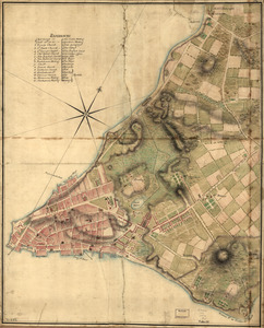
A Plan of Albany, as it was in the year 1758
Library of Congress Collection
See map
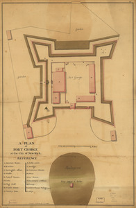
A plan of Fort George at the city of New-York
Library of Congress Collection
See map
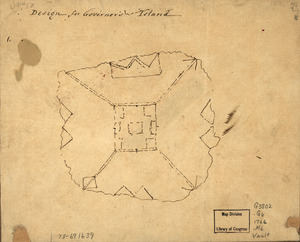
Design for Governor's Island
Library of Congress Collection
See map
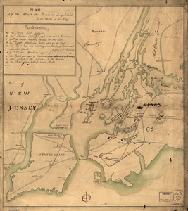
Plan of the attack the rebels on Long Island, by an officer of the Army
Library of Congress Collection
See map
A survey of Frog's Neck and the rout[e] of the British Army
Library of Congress Collection
See map
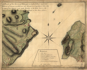
A plan of the Narrows of Hells-gate in the East River
Library of Congress Collection
See map
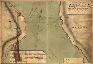
Plan of The Narrows, shewing the channel, shoal, depth of water, and the several battery's proposed on each side to prevent an enemy's sailing up to New York
Library of Congress Collection
See map
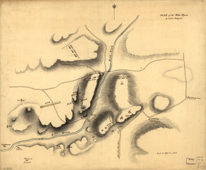
Sketch of the White Plains
Library of Congress Collection
See map
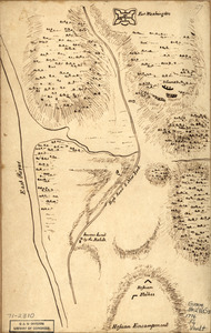
Fort Washington & vicinity
Library of Congress Collection
See map
Showing
397
to
408
of
946
results
Previous
Next


![A survey of Frog's Neck and the rout[e] of the British Army](https://bpldcassets.blob.core.windows.net/derivatives/images/commonwealth:q524n8606/image_thumbnail_300.jpg)