ARGO Home
Open menu
Stories
Themes
People
Partner Collections
About ARGO
Search
Languages:
English
English
French
German
Latin
Spanish
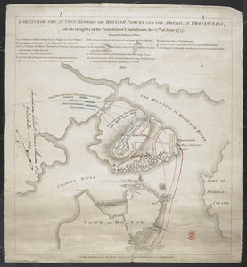
A SKETCH OF THE ACTION BETWEEN THE BRITISH FORCES AND THE AMERICAN PROVINCIALS, on the Heights of the Peninsula of Charlestown, the 17th June 1775
British Library Collection
See map
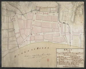
A PLAN of the City of ALBANY Shewing the Several works and Buildings made there in the Year 1756 & 57
British Library Collection
See map
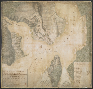
PLAN of the FORT in TIENDEROGA and Environs at the head of LAKE CHAMPLAIN November 1759
British Library Collection
See map
PLAN of part of FORT GEORGE with the BARRACKS &c Erected in the Year 1759
British Library Collection
See map
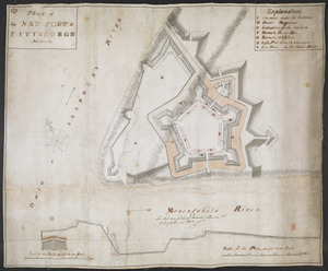
PLAN of the NEW FORT at PITTSBURGH November 1759
British Library Collection
See map
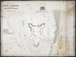
PLAN of FORT LIGONIER with part of the RETRENCHMENT
British Library Collection
See map
[Map showing operations against Philadelphia by the British in November 1777]
British Library Collection
See map
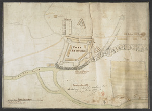
FORT BEDFORD
British Library Collection
See map
[Account of the action at Fort Niagara]
British Library Collection
See map
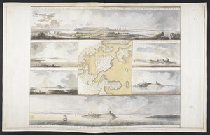
VIEW of BOSTON the Capital of NEW ENGLAND from Col. HATCH's House on the Road to DORCHESTER = VIEW FROM DORCHESTER NECK = VIEW of CASTLE WILLIAM at Station C = VIEW FROM CHARLESTOWN = VIEW OF CASTLE WILLIAM at Station D = VIEW of CASTLE WILLIAM
British Library Collection
See map
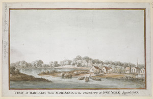
VIEW of HARLAEM from MORISANIA in the PROVINCE of NEW YORK Septem.r 1765
British Library Collection
See map
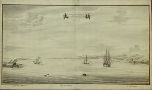
A Prospect of LOUISBOURG taken from ye NE Harbour
British Library Collection
See map
Showing
109
to
120
of
1647
results
Previous
Next

![[Map showing operations against Philadelphia by the British in November 1777]](https://bpldcassets.blob.core.windows.net/derivatives/images/commonwealth:6108vv61k/image_thumbnail_300.jpg)
![[Account of the action at Fort Niagara]](https://bpldcassets.blob.core.windows.net/derivatives/images/commonwealth:6108vv66z/image_thumbnail_300.jpg)