ARGO Home
Open menu
Stories
Themes
People
Partner Collections
About ARGO
Search
Languages:
English
English
French
German
Latin
Spanish
PLAN of FORT FREDERICK at NEWFOUND-LAND as it is now with the new Additions
British Library Collection
See map
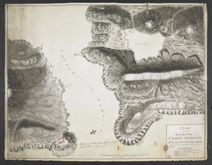
[Map showing Saint John's Harbour with Fort William and Fort Townshend]
British Library Collection
See map
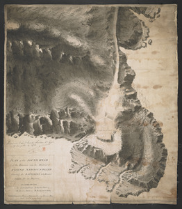
PLAN of the SOUTH HEAD of the Entrance into the Harbour of St IOHNS NEWFOUNDLAND Shewing the BATTERIES to be Erected theron for its Defence
British Library Collection
See map
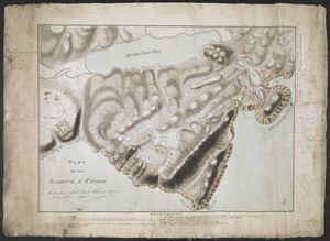
PART OF THE HARBOUR of ST IOHNS
British Library Collection
See map
PLAN OF THE ENTRANCE OF ST IOHN'S HARBOUR NEWFOUNDLAND Shewing the additional Work's erecting for its defence
British Library Collection
See map
[Entrance to the Harbour of S.t Johns Newfoundland]
British Library Collection
See map
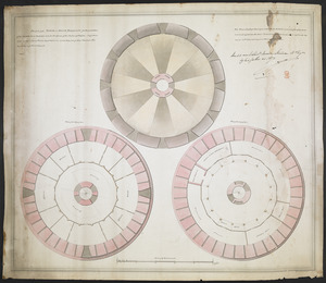
[Six sectional drawings of the Harbour of Saint John, Newfoundland]
British Library Collection
See map
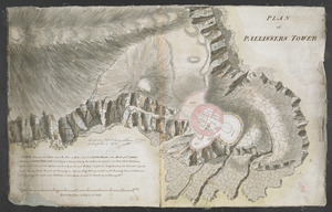
PLAN of PALLISSERS TOWER
British Library Collection
See map
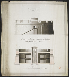
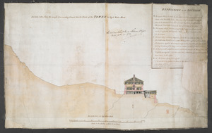
Section taken from the nearest Commanding Ground thro' the Center of the TOWER to High Water Mark
British Library Collection
See map
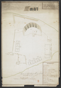
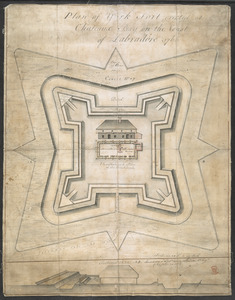
Plan of York Fort erected at Chateaux bay on the Coast of Labradore 1766
British Library Collection
See map
PLAN of the TOWER at POINT PLEASANT for the protection of the Sea Batteries at that place and for the defence of the Harbour of Halifax -
British Library Collection
See map
ELEVATION and SECTION of the TOWER at POINT PLEASANT
British Library Collection
See map
Showing
97
to
108
of
1647
results
Previous
Next
![[Map showing Saint John's Harbour with Fort William and Fort Townshend]](https://bpldcassets.blob.core.windows.net/derivatives/images/commonwealth:6108vv278/image_thumbnail_300.jpg)
![[Six sectional drawings of the Harbour of Saint John, Newfoundland]](https://bpldcassets.blob.core.windows.net/derivatives/images/commonwealth:6108vv37h/image_thumbnail_300.jpg)
![[Entrance to the Harbour of S.t Johns Newfoundland]](https://bpldcassets.blob.core.windows.net/derivatives/images/commonwealth:6108vv35z/image_thumbnail_300.jpg)