ARGO Home
Open menu
Stories
Themes
People
Partner Collections
About ARGO
Search
Languages:
English
English
French
German
Latin
Spanish
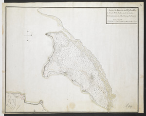
[Map showing rivers and forts in North America]
British Library Collection
See map
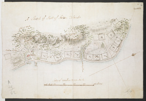
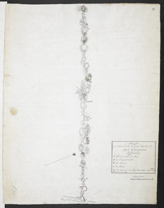
A Sketch of Part of Staten Island
British Library Collection
See map
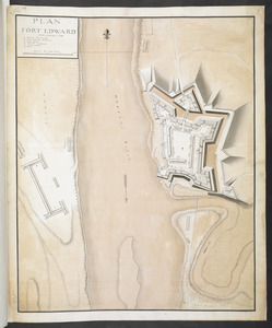
PLAN FORT EDWARD
British Library Collection
See map
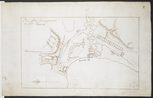
Plan of the Incampement at Fort Edward
British Library Collection
See map
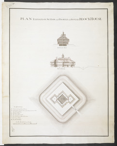
PLAN ELEVATION SECTION and PROFILE of ye ROYAL BLOCKHOUSE
British Library Collection
See map
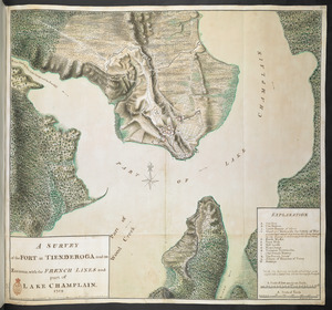
A SURVEY of the FORT at TIENDEROGA and its Environs, with the FRENCH LINES and part of LAKE CHAMPLAIN 1759
British Library Collection
See map
Sketch of the Isthmus to the NE of Crown Point
British Library Collection
See map
Draught of a Scout over the Mountains West-ward of Lake Champlain
British Library Collection
See map
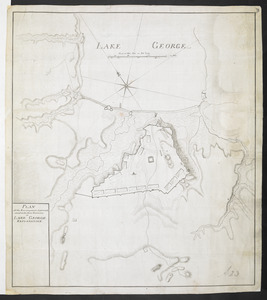
PLAN of the Encampment Intrenchment with thier Environs at LAKE GEORGE
British Library Collection
See map
PLAN of the Encampement at Lake George the 27th Iuin 1759
British Library Collection
See map
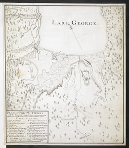
PLAN OF FORT Wm HENRY and the English Camps & Retranchment, with the French different Camps & Attack there upon
British Library Collection
See map
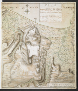
PLAN of the Designed FORT GEORGE at present executing, Shewing its situation and part of its Environs. July the 17.th 1759
British Library Collection
See map
Showing
481
to
492
of
1647
results
Previous
Next
![[Map showing rivers and forts in North America]](https://bpldcassets.blob.core.windows.net/derivatives/images/commonwealth:hx11z163x/image_thumbnail_300.jpg)