ARGO Home
Open menu
Stories
Themes
People
Partner Collections
About ARGO
Search
Languages:
English
English
French
German
Latin
Spanish
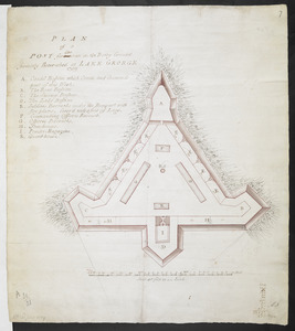
PLAN of a POST for 430 men on the Rocky Ground formerly Retrenched at LAKE GEORGE 1759
British Library Collection
See map
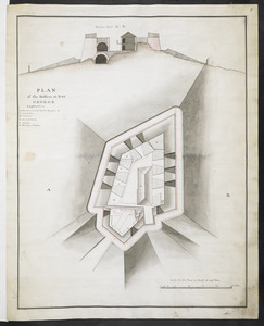
PLAN of the Bastion at Fort George
British Library Collection
See map
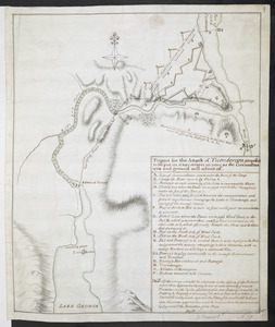
Project for the Attack of Ticonderoga, proposed to be put in executino as near as the circumstances and ground will admit of
British Library Collection
See map
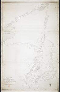
A MAP of the PROVINCE of NEW YORK & Part of NEW ENGLAND & NEW JERSEY with Part of NEW FRANCE the whole Compsed from Actual Surveys by a Scale 8 miles to a Inch
British Library Collection
See map
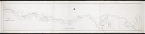
PART OF HUDSON'S RIVER
British Library Collection
See map
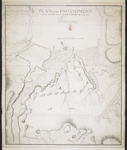
PLAN OF THE ENCAMPMENT OF THE ARMY AT LAKE GEORGE JUNE 1759
British Library Collection
See map
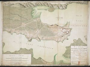
PLAN of the FORTRESS and dependant FORTS at CROWN POINT with their Environs and part of LAKE CHAMPLAIN. 1759
British Library Collection
See map
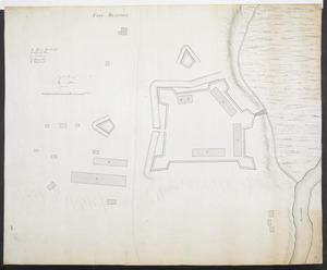
FORT BEDFORD
British Library Collection
See map
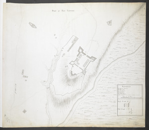
PLAN of FORT LIGONIER
British Library Collection
See map
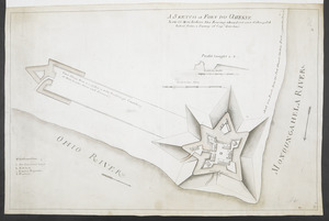
A SKETCH of FORT DU QUESNE how it was before the Enemy abandont and distryd it taken from a survey of Cap.t Gordon's
British Library Collection
See map
[Map showing Fort Pitt, Fort Duquesne and Fort Mercer]
British Library Collection
See map
[Map of Fort Pitt]
British Library Collection
See map
Showing
493
to
504
of
1647
results
Previous
Next
![[Map showing Fort Pitt, Fort Duquesne and Fort Mercer]](https://bpldcassets.blob.core.windows.net/derivatives/images/commonwealth:hx11z222w/image_thumbnail_300.jpg)
![[Map of Fort Pitt]](https://bpldcassets.blob.core.windows.net/derivatives/images/commonwealth:hx11z224f/image_thumbnail_300.jpg)