ARGO Home
Open menu
Stories
Themes
People
Partner Collections
About ARGO
Search
Languages:
English
English
French
German
Latin
Spanish
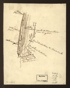
Map showing roads to Morristown
Library of Congress Collection
See map
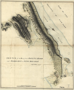
Sketch of the road from Paulus Hook and Hobocken to New Bridge
Library of Congress Collection
See map
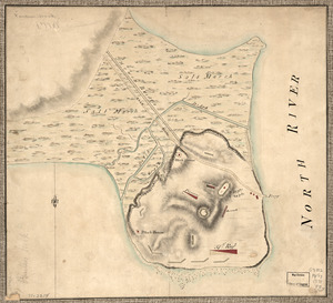
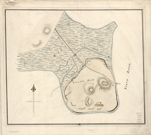
Plan of Paulus's Hook and fortifications
Library of Congress Collection
See map
Plan of Paulus's Hook and fortifications
Library of Congress Collection
See map
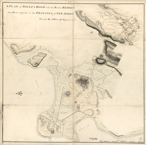
A plan of Paulus Hook with the road to Bergen and parts adjacent in the province of New Jersey
Library of Congress Collection
See map
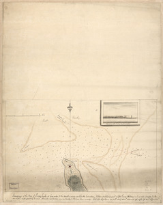
Soundings of the bar of Sandy Hook at low water & the marks made use of for the best water
Library of Congress Collection
See map
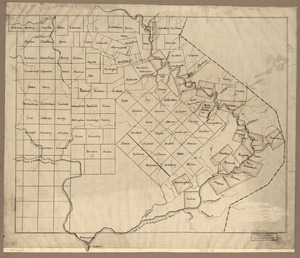
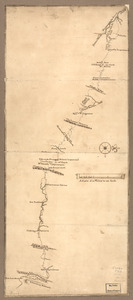
The Part of Pennsylvania that lies between the forks of the Susquehannah, divided into townships
Library of Congress Collection
See map
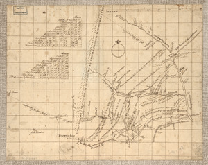
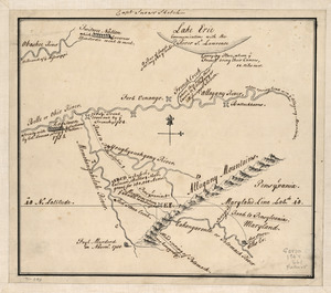
Captain Snow's sketch
Library of Congress Collection
See map
Mr. Armstrong's rough draft of the country to the west of Susquehanna
Library of Congress Collection
See map
Map of a route through south west Pennsylvania from Fort Loudon, Franklin Co. to Fort Pitt, Pittsburgh
Library of Congress Collection
See map
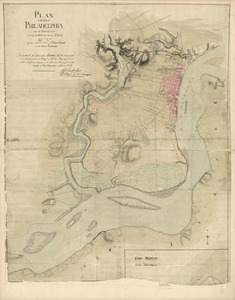
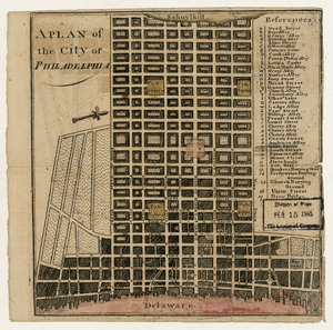
A plan of the city of Philadelphia
Library of Congress Collection
See map
Plan of the city of Philadelphia and its environs shewing its defences during the years 1777 & 1778
Library of Congress Collection
See map
Showing
841
to
852
of
1647
results
Previous
Next