ARGO Home
Open menu
Stories
Themes
People
Partner Collections
About ARGO
Search
Subject:
Houses and Property
Borders
Indigenous Peoples
Roads and Routes
Houses and Property
Military
Westchester County coast, New Rochelle to Horseneck River: unfinished
Library of Congress Collection
See map
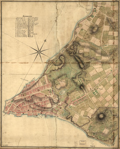
A Plan of the city of New York
Library of Congress Collection
See map
A Plan of Albany, as it was in the year 1758
Library of Congress Collection
See map
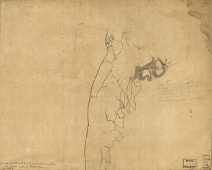
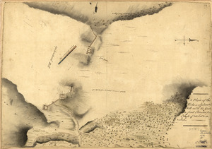
A survey of Frog's Neck and the rout[e] of the British Army
Library of Congress Collection
See map
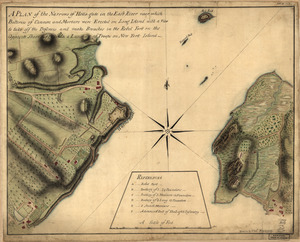
A plan of the Narrows of Hells-gate in the East River
Library of Congress Collection
See map
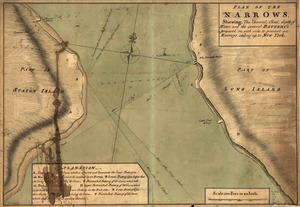
Plan of The Narrows, shewing the channel, shoal, depth of water, and the several battery's proposed on each side to prevent an enemy's sailing up to New York
Library of Congress Collection
See map
A tracing relating to Fort Washington or Knyphausen
Library of Congress Collection
See map
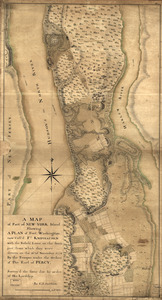
A map of part of New-York Island showing a plan of Fort Washington
Library of Congress Collection
See map
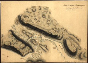
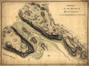
Sketch of the Heights of Kingsbridge 1777, with the proposed redoubts coloured orange
Library of Congress Collection
See map
Sketch of the Heights of Kingsbridge, with the proposed redouts couloured yellow
Library of Congress Collection
See map
A Plan of the works on Spikendevil Hill with the ground in front, protracted from a scale of 200 feet to an inch
Library of Congress Collection
See map
Skecth [sic] of the road from Kings Bridge to White Plains
Library of Congress Collection
See map
Showing
385
to
396
of
967
results
Previous
Next

![A survey of Frog's Neck and the rout[e] of the British Army](https://bpldcassets.blob.core.windows.net/derivatives/images/commonwealth:q524n8606/image_thumbnail_300.jpg)

![Skecth [sic] of the road from Kings Bridge to White Plains](https://bpldcassets.blob.core.windows.net/derivatives/images/commonwealth:q524n8895/image_thumbnail_300.jpg)