ARGO Home
Open menu
Stories
Themes
People
Partner Collections
About ARGO
Search
Subject:
Houses and Property
Borders
Indigenous Peoples
Roads and Routes
Houses and Property
Military
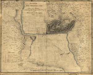
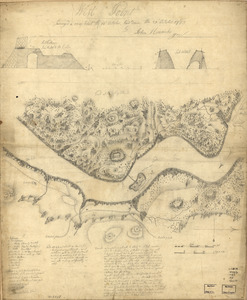
Position of the detachment under Lieut't Col. Baum & attacks of the enemy on the 16th August at Walmscock near Benington, 1777
Library of Congress Collection
See map
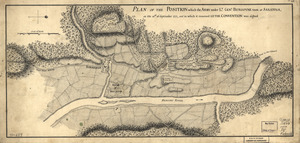
Plan of the position which the army under Lt. Genl. Burgoyne took at Saratoga
Library of Congress Collection
See map
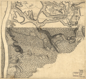
Plan of the encampment and position of the army under His Excelly. Lt. General Burgoyne
Library of Congress Collection
See map
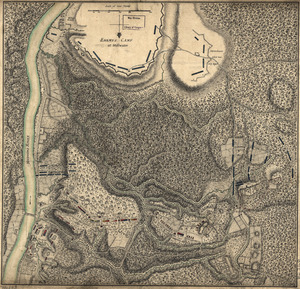
Plan of the encampment and position of the army under His Excelly. Lt. General Burgoyne
Library of Congress Collection
See map
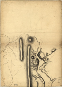
Part of a map of the Hudson Highlands showing Forts Clinton and Montgomery
Library of Congress Collection
See map
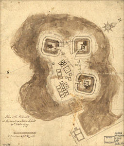
Plan of the redoubts at Richmond on Staten Island, 30th October 1779
Library of Congress Collection
See map
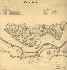
West Point
Library of Congress Collection
See map
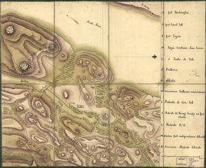
West Point
Library of Congress Collection
See map
Reconnoissance de King's bridge
Library of Congress Collection
See map
Reconnoissance des ouvrages du nord de l'Isle de Newyork dont on a déterminé géometriquement les principaux points le 22 et le 23 juillet
Library of Congress Collection
See map
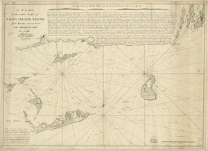
A plan of the east part of Long Island Sound
Library of Congress Collection
See map
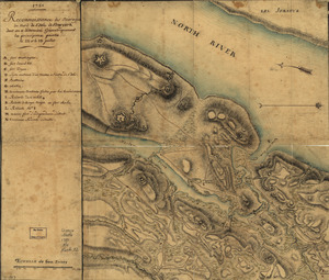
Map showing the west shore of the North or Hudson River
Library of Congress Collection
See map
Showing
397
to
408
of
967
results
Previous
Next