ARGO Home
Open menu
Stories
Themes
People
Partner Collections
About ARGO
Search
Subject:
Indigenous Peoples
Borders
Indigenous Peoples
Roads and Routes
Houses and Property
Military
A Sketch of Lake Ontario between Oswego and Niagara and from thence up the River to the upper end of the Carrying place
British Library Collection
See map
French Draught of Lake Champlain & Lake George
British Library Collection
See map
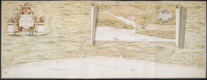
[A map of Fort Carillon and environs]
British Library Collection
See map
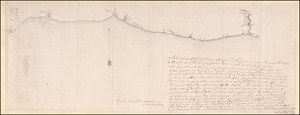
The Course of the Wood Creek from the Mowhock River at the Onoida or Great Carrying Place to The Onoida Lake. Representing the Forts built on the Carrying Place by order of General Shirley: and Afterwards destroyed by Major General Webb
British Library Collection
See map
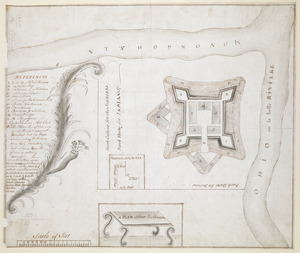
[A map of the River Schohary with a plan and elevation of the new fort]
British Library Collection
See map
A PLAN of FORT De Quesne
British Library Collection
See map
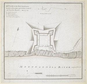
A PLAN of the Fort for 220 men built in December 1758 within 400 Yard's of Fort du Quesne
British Library Collection
See map
PLAN OF THE PENINSULA OF CHESOPEAK BAY
British Library Collection
See map
MAP of the Western parts of the COLONY of VIRGINIA, as far as the Mississipi
British Library Collection
See map
[Coast of South Carolina, Georgia and Florida from Charleston to St. Augustine]
British Library Collection
See map
[Coast of South Carolina, Georgia and Florida from Charleston to St. Augustine]
British Library Collection
See map
A Survey of the Coast from FORT WILLIAM near S.t Iuans River to Mosquito River
British Library Collection
See map
Showing
169
to
180
of
598
results
Previous
Next

![[A map of the River Schohary with a plan and elevation of the new fort]](https://bpldcassets.blob.core.windows.net/derivatives/images/commonwealth:hx11z356x/image_thumbnail_300.jpg)

![[Coast of South Carolina, Georgia and Florida from Charleston to St. Augustine]](https://bpldcassets.blob.core.windows.net/derivatives/images/commonwealth:hx11z448f/image_thumbnail_300.jpg)
![[Coast of South Carolina, Georgia and Florida from Charleston to St. Augustine]](https://bpldcassets.blob.core.windows.net/derivatives/images/commonwealth:hx11z450g/image_thumbnail_300.jpg)
![[A map of Fort Carillon and environs]](https://bpldcassets.blob.core.windows.net/derivatives/images/commonwealth:hx11z342k/image_thumbnail_300.jpg)