ARGO Home
Open menu
Stories
Themes
People
Partner Collections
About ARGO
Search
Subject:
Military
Borders
Indigenous Peoples
Roads and Routes
Houses and Property
Military
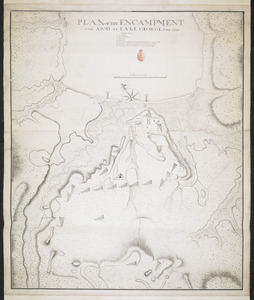
PLAN OF THE ENCAMPMENT OF THE ARMY AT LAKE GEORGE JUNE 1759
British Library Collection
See map
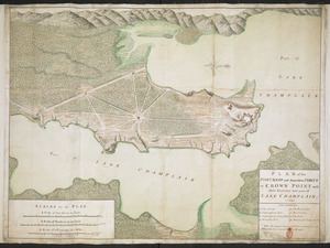
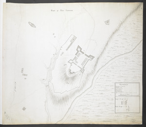
PLAN of the FORTRESS and dependant FORTS at CROWN POINT with their Environs and part of LAKE CHAMPLAIN. 1759
British Library Collection
See map
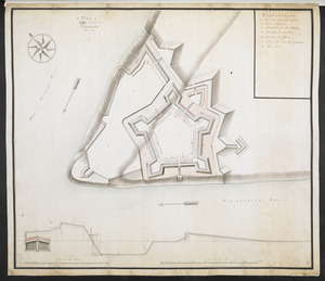
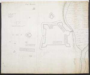
FORT BEDFORD
British Library Collection
See map
PLAN of FORT LIGONIER
British Library Collection
See map
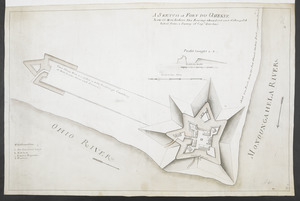
A SKETCH of FORT DU QUESNE how it was before the Enemy abandont and distryd it taken from a survey of Cap.t Gordon's
British Library Collection
See map
[Map showing Fort Pitt, Fort Duquesne and Fort Mercer]
British Library Collection
See map
[Map of Fort Pitt]
British Library Collection
See map
A Plan of Pitts Fort at Pittsburgh. Oct.r 1759
British Library Collection
See map
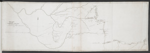
SKETCH OF THE CHEROKEE COUNTRY And March of the Troops Under the Command of Luet. Col. Grant to the Middle & Back Settlem:ts. 1761
British Library Collection
See map
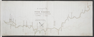
A SKETCH of the RIVER MISSISIPPI from New Orleans to the Rock of Davion
British Library Collection
See map
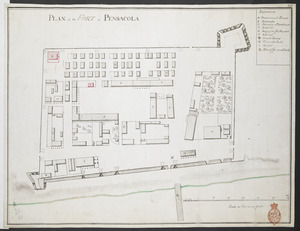
PLAN of the FORT at PENSACOLA
British Library Collection
See map
[Map showing military locations from Fort Cumberland on the River Potomac to Fort Presqu'Isle on Lake Erie]
British Library Collection
See map
Showing
241
to
252
of
876
results
Previous
Next
![[Map showing military locations from Fort Cumberland on the River Potomac to Fort Presqu'Isle on Lake Erie]](https://bpldcassets.blob.core.windows.net/derivatives/images/commonwealth:hx11z2367/image_thumbnail_300.jpg)
![[Map showing Fort Pitt, Fort Duquesne and Fort Mercer]](https://bpldcassets.blob.core.windows.net/derivatives/images/commonwealth:hx11z222w/image_thumbnail_300.jpg)
![[Map of Fort Pitt]](https://bpldcassets.blob.core.windows.net/derivatives/images/commonwealth:hx11z224f/image_thumbnail_300.jpg)