ARGO Home
Open menu
Stories
Themes
People
Partner Collections
About ARGO
Search
Subject:
Military
Borders
Indigenous Peoples
Roads and Routes
Houses and Property
Military
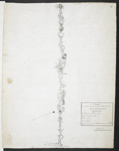
Draught of a Scout over the Mountains West-ward of Lake Champlain
British Library Collection
See map
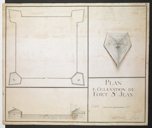
PLAN E L'ELEVATION DU FORT S.T JEAN
British Library Collection
See map
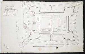
Plan du fort S.t Jean
British Library Collection
See map
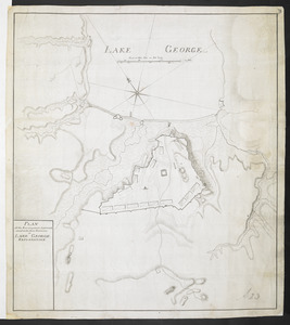
[Plan Du fort Georges appelé par les Anglois William-Henri prie par les francois en 1757 le 9 Aout]
British Library Collection
See map
PLAN of the Encampment Intrenchment with thier Environs at LAKE GEORGE
British Library Collection
See map
PLAN of the Encampement at Lake George the 27th Iuin 1759
British Library Collection
See map
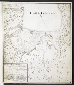
PLAN OF FORT Wm HENRY and the English Camps & Retranchment, with the French different Camps & Attack there upon
British Library Collection
See map
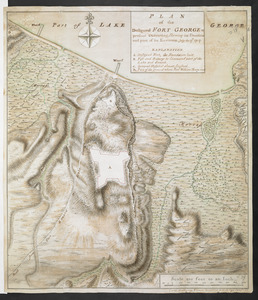
PLAN of the Designed FORT GEORGE at present executing, Shewing its situation and part of its Environs. July the 17.th 1759
British Library Collection
See map
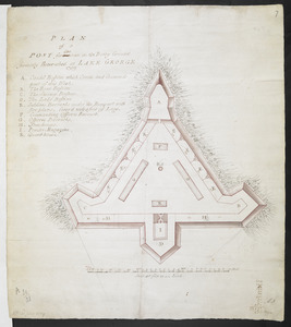
PLAN of a POST for 430 men on the Rocky Ground formerly Retrenched at LAKE GEORGE 1759
British Library Collection
See map
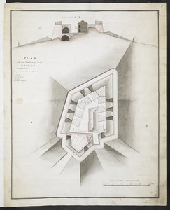
PLAN of the Bastion at Fort George
British Library Collection
See map
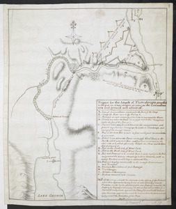
Project for the Attack of Ticonderoga, proposed to be put in executino as near as the circumstances and ground will admit of
British Library Collection
See map
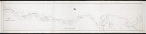
PART OF HUDSON'S RIVER
British Library Collection
See map
Showing
229
to
240
of
876
results
Previous
Next
![[Plan Du fort Georges appelé par les Anglois William-Henri prie par les francois en 1757 le 9 Aout]](https://bpldcassets.blob.core.windows.net/derivatives/images/commonwealth:hx11z1913/image_thumbnail_300.jpg)