ARGO Home
Open menu
Stories
Themes
People
Partner Collections
About ARGO
Search
Subject:
Military
Borders
Indigenous Peoples
Roads and Routes
Houses and Property
Military
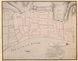
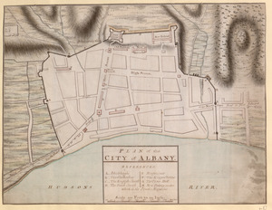
PLAN of the City of ALBANY Shewing the Several works & Buildings made there in the Years 1756 & 57
British Library Collection
See map
PLAN of the CITY of ALBANY
British Library Collection
See map
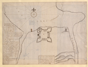
A PLAN of FORT FREDERIC situate on the South Side of LAKE CHAMPLAIN and on the West Side of Wood CREEK built within the bounds of the Province of New York by the French anno Domini 1731/32
British Library Collection
See map
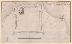
Crown Point or S.t Frederick's Fort at the Head of Lake Champlain and the Mouth of Wood Creek
British Library Collection
See map
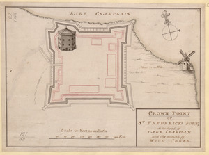
CROWN POINT or ST. FREDERICK'S FORT at the head of LAKE CHAMPLAIN and the Mouth of WOOD CREEK
British Library Collection
See map
A Draught of the Fortress building at Crown Point 22.d Oct.t 1759
British Library Collection
See map
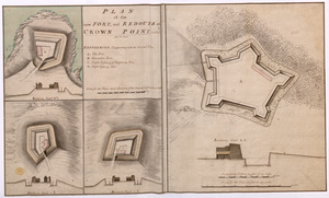
PLAN of the new FORT, and REDOUTS at CROWN POINT, called as below
British Library Collection
See map
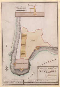
PROJECT for taking POST at CROWN POINT
British Library Collection
See map
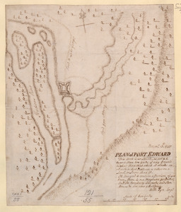
PLAN of FORT EDWARD
British Library Collection
See map
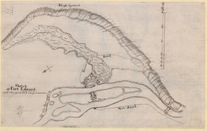
Sketch of Fort Edward and the proposed improvements
British Library Collection
See map
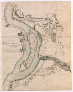
Plan of the Environs of Fort Edward
British Library Collection
See map
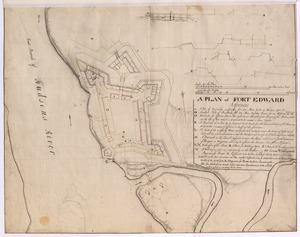
A PLAN of FORT EDWARD
British Library Collection
See map
Showing
301
to
312
of
876
results
Previous
Next