ARGO Home
Open menu
Stories
Themes
People
Partner Collections
About ARGO
Search
Subject:
Military
Borders
Indigenous Peoples
Roads and Routes
Houses and Property
Military
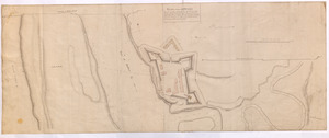
PLAN of Fort Edward
British Library Collection
See map
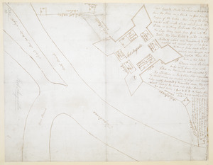
PLAN of Fort EDWARD
British Library Collection
See map
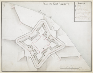
Fort Augusta
British Library Collection
See map
PLAN DU FORT AUGUSTA
British Library Collection
See map
[Fort Bedford, on the Juniata Creek]
British Library Collection
See map
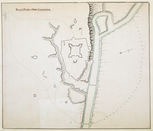
Rough PLAN of FORT LIGONIER
British Library Collection
See map
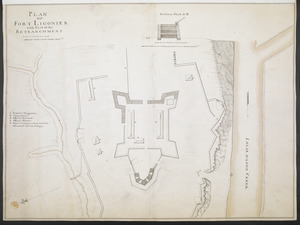
PLAN OF FORT LIGONIER with Part of the RETRANCHMENT
British Library Collection
See map
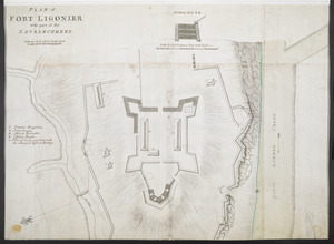
PLAN of FORT LIGONIER with part of the RETRENCHMENT
British Library Collection
See map
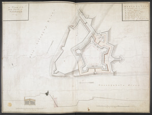
A PLAN of FORT De Quesne
British Library Collection
See map
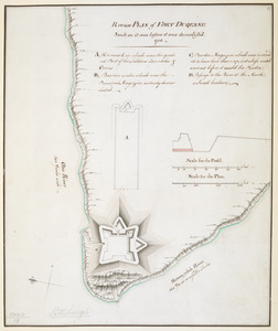
Rough PLAN of FORT DUQUESNE such as it was before it was demolish'd 1758
British Library Collection
See map
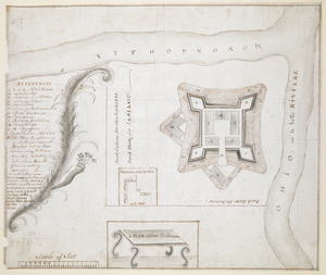
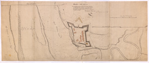
A plan of the New Fort at Pittsburgh Novr 1759
British Library Collection
See map
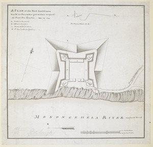
A PLAN of the Fort for 220 men built in December 1758 within 400 Yard's of Fort du Quesne
British Library Collection
See map
Showing
313
to
324
of
876
results
Previous
Next
![[Fort Bedford, on the Juniata Creek]](https://bpldcassets.blob.core.windows.net/derivatives/images/commonwealth:hx11z402t/image_thumbnail_300.jpg)