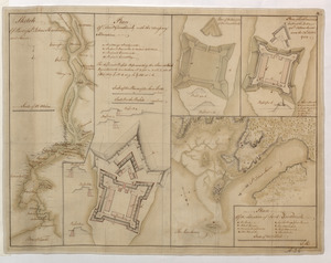
Sketch Of Part of S.t John's Harbour and River= Plan of Fort Frederick with the Necessary Alterations= Plan of the Ramainder of the French Fort= Plan of Fort Frederick built at the Entrance of S.t John's River since the 24.th Septemr 1758.= Plan Of the Situation of Fort Frederick
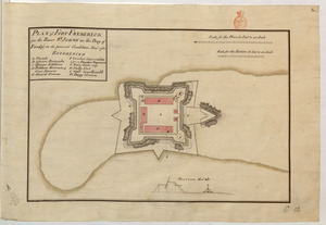
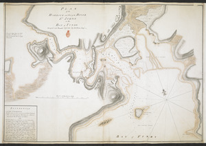
Plan of the Harbour of St John's in the Bay of Fundy= Plan & Section of the Fort as it is Near Finish'd= Plan & Section's of the Remains of the old French Fort
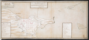
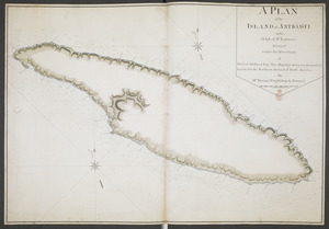
A PLAN of the ISLAND of ANTICOSTI in the Gulph of S.T Lawrence Surveyed under the Directions of Samuel Holland Esq.r His Majesty's Surveyor General of Lands for the Northern District of North America

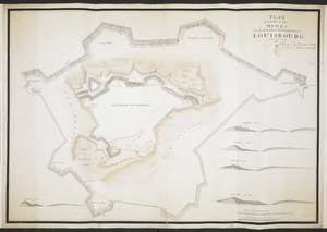

![[Chart of the Saint Lawrence River]](https://bpldcassets.blob.core.windows.net/derivatives/images/commonwealth:hx11z0594/image_thumbnail_300.jpg)