ARGO Home
Open menu
Stories
Themes
People
Partner Collections
About ARGO
Search
Subject:
Military
Borders
Indigenous Peoples
Roads and Routes
Houses and Property
Military
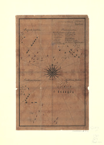
Quatre positions de la flotte française et positions de la flotte anglaise
Library of Congress Collection
See map
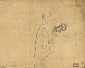
Gov. Tryon's expedition to Danbury, 1777
Library of Congress Collection
See map
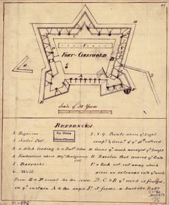
Fort-Griswold
Library of Congress Collection
See map
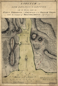
A sketch of New London & Groton with the attacks made on Forts Trumbull & Griswold by the British troops
Library of Congress Collection
See map
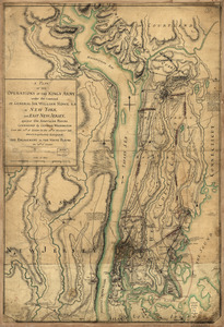
A plan of the operations of the King's army
Library of Congress Collection
See map
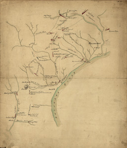
Operations of the British army, from the 25th August to 26th Sept. 1777
Library of Congress Collection
See map
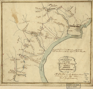
Progress of the army from their landing till taking possession of Philadelphia
Library of Congress Collection
See map
This is not given as an accurate map, but only to afford an idea of the progress of the army from the landing at Elk to the taking of possession of Philadelphia
Library of Congress Collection
See map
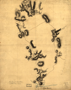
A draught of Lake George, and part of Hudson's River taken September 1756
Library of Congress Collection
See map
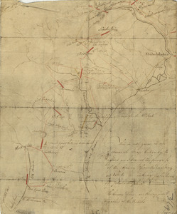
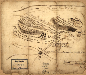
Country between North River and Croton River
Library of Congress Collection
See map
Westchester County coast, New Rochelle to Horseneck River: unfinished
Library of Congress Collection
See map
Ticonderoga as it was in 1759
Library of Congress Collection
See map
Showing
409
to
420
of
876
results
Previous
Next