Biography written by Sam Dinnie
Nathaniel Dwight was a scion of the Connecticut Valley River Gods, surveyor, militia captain in the Crown Point Expedition of 1755, and one of the earliest settlers of Cold Spring, Massachusetts (now Belchertown), where he held numerous local offices. Dwight’s enterprises, combined with his extensive land holdings, brought him to the furthest western, northern, southern, and eastern reaches of western Massachusetts, making him an integral provincial surveyor.
Dwight was born on June 20, 1712, in Northampton, Massachusetts, to Nathaniel Dwight and Mehetable Partridge Dwight. Both the Dwight and Partridge surnames bestowed the younger Nathaniel with the unexampled wealth and prestige of the Connecticut Valley River Gods. The River Gods were regarded by contemporaries as “the old established gentry of Western Massachusetts, connected by blood and friendship.”1 This tight-knit kinship network exercised near absolute control over the Connecticut Valley in western Massachusetts, occupying the pulpits of almost every town; controlling the region’s defense and recruiting officers based on shared elite interests; and governing the bench and bar to impose their values through adjudication.2 Part of what afforded the River Gods so much power was the political patronage of Crown-appointed royal governors seated in Boston. Far removed from Dwight’s native Hampshire County, governors made the River Gods their chief advisors in western matters by awarding them judicial, political, and military appointments, as well as generous land grants, which solidified the River Gods’ regional dominance.3 Dwight was born into this world of wealth and patronage, and his privileged family ties enabled him to become a prominent surveyor and militia captain, as well as inherit and receive tracts of land throughout western Massachusetts.
Likely sometime between 1731 and 1734, Dwight was deeded rights to lands in Cold Spring and left Northampton to live in the new settlement southwest of the present-day Quabbin Reservoir.4 Dwight quickly proved to be a preeminent member of the budding town and soon began operating an inn that he would run into the 1770s.5 Dwight was also involved in town politics. In county court and town documents, Dwight gave his seal as sheriff, town clerk, and town selectman throughout the years.6 While important, Dwight’s innkeeping and office holdings were not the true sources of his prominence in Cold Spring, which would be renamed Belchertown in 1761. Like other River Gods, extensive land ownership was the source of his eminence. Numerous land deeds document Dwight’s transactions, including sales of his lands in Worthington and Tyringham, Massachusetts, and land leases to local tenants.7 In 1771, he even petitioned the Massachusetts House of Representatives “praying for a Grant of Land in the Western Part of the Province.”8
Dwight’s acquisition of so much real estate was interconnected with his work as a surveyor, as were his frequent appointments to view, survey, and lay out highways throughout western Massachusetts that encompassed lands and townships in the westernmost Berkshire County, the length of the Connecticut River Valley, and the border of Hampshire and Worcester Counties.9 His familiarity with the topography, Native American territory, white settlements, and unsettled lands of western Massachusetts made him an invaluable asset to provincial surveying. The vast terrain Dwight traversed was comprehensively mapped by Osgood Carleton in the 1790s as part of his larger map of Massachusetts and provides a useful visual in conceptualizing the areas Dwight’s surveyed.
Dwight’s first commission as a surveyor was from the Massachusetts House of Representatives in 1732. His surveying party traveled north to the present-day borders of western Massachusetts and New Hampshire along the Ashuelot and Miller Rivers, both of which join the mighty Connecticut. The survey mapped “A Plat containing two thousand three hundred and forty acres of Land… lying at a place called Paquioag on Miller’s River.”10 In concert with another surveyor, Dwight also “platted” one of two new “Townships, each of the contents of six Miles square, situate[d] on each side of Ashuelot River in the County of Hampshire,” thus pushing the boundaries of invasive white settlement farther north.11 Although not in the records of the Massachusetts House of Representatives, Dwight also surveyed and mapped the Berkshire County township of New Framingham (now Lanesborough, Massachusetts, which is just north of Pittsfield and close to the border of Massachusetts and New York) in 1761 and Roads Town (now Shutesbury, Massachusetts, a town north of Belchertown and east of South Deerfield in present-day Franklin County) in 1765.12
Dwight also learned the lay of the western Massachusetts land as a militia officer. In 1755, he marched with a regiment from Deerfield, Massachusetts, to the Champlain Valley in New York on the Crown Point Expedition during the French and Indian War (1754–1763). Dwight, apparently having no previous military experience, received a captaincy commission from Governor William Shirley. Shirley was well versed in the art of patronage and commissioned multiple River Gods to be officers in the war.13 Dwight kept a journal of his experience on the Crown Point Expedition, in which he detailed the dimensions of Fort William Henry, prompting some to speculate that Dwight designed and laid out the fort.14 The Crown Point Expedition seems to have marked the end of Dwight’s short-lived military career. Afterwards he petitioned the Massachusetts House of Representatives “praying for an Allowance of his Expences occasioned” by his “[taking] sick on his return Home after the Army was dismis’d.”15
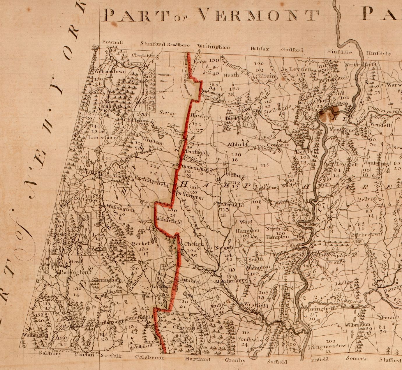
Dwight’s captaincy, surveying experience, and recognizable surname likely secured him a 1762 commission from the Massachusetts House to “Survey the said” recently purchased “Townships and Tracts of Land,” as well as “the remaining unappropriated Lands of the Province, in the Counties of Hampshire and Berkshire.”16 From this survey Dwight produced his map of the Province of the Massachusetts Bay…, which, as the extended title makes clear, delineates nine townships, covers 10,000 acres, and includes all unappropriated land in Hampshire and Berkshire Counties. Upon examination of Dwight’s survey, the House found that “some of the Towns interfere with former Grants of this Court” and appointed a committee to resolve the matter in 1763.17 The same committee was also tasked with considering a 1762 petition the Stockbridge Indians submitted to the House in response to the legislature deeding tribal land in Stockbridge to white settlers.18 Dwight’s survey had mapped the contested territory, and he did not designate the Stockbridge lands that the petitioning Native Americans had sovereign rights and claim to. Dwight’s survey and map thus facilitated the expansion of white settlement into the interior of Massachusetts that dispossessed and displaced the Stockbridge Indians and other Native peoples. Grant requests for the land Dwight surveyed abound the House of Representatives journals after 1762, and the issue was so pertinent that Dwight was appointed to a committee in 1770 “to make Enquiry and endeavor to find out all the unappropriated Lands belonging to this Province, lying either within the County of Hampshire or Berkshire.”19
Dwight continued his highway and survey work into the 1770s, during which time he remained in town government and in pursuit of land sales, purchases, and leases.20 He also proved to be a friend of the patriot cause and proponent of American Independence, unlike many of his kin.21 Dwight signed a declaration of support for the ad hoc Massachusetts Bay government in their resistance efforts against Great Britain and, as town clerk, recorded the unanimous town meeting vote to support the Continental Congress in declaring independence.22
After an accomplished career, Nathaniel Dwight died on March 30, 1784, in Belchertown. An elaborate headstone stands as a monument to his memory in Belchertown’s South Cemetery, a fitting tribute in a town that still honors his local legacy.
Banner image: detail from Province of the Massachusetts Bay & pursuant to an order made by the great & Genl. Court of the province June 11th 1762
Bibliography
“Archival Holdings of the Belchertown Historical Association.” Belchertown Historical Association. Compiled 2004, Updated 2020, http://stonehousemuseum.org/wp-content/uploads/2020/01/Archival-Holdings-List.pdf.
Belchertown Historical Association. “Archival Holdings of the Belchertown Historical Association.” Stone House Museum. Compiled 2004, updated 2020. Accessed 8 February 2023, http://stonehousemuseum.org/wp-content/uploads/2020/01/Archival-Holdings-List.pdf.
Berkshire Historical Society Manuscript Collections. Berkshire Historical Society, Pittsfield, MA.
Dewey, Mary E., ed. Life and Letters of Catherine M. Sedgwick. New York: Harper and Brothers, 1871.
Dwight, Benjamin W. The History of the Descendants of John Dwight, of Dedham, Mass. Vol. 1. New York: John F. Trow & Son, 1874.
Dwight, Nathaniel. Map of Shutesbury Proprietors’ Shares. Historic Maps, Town of Shutesbury, MA. Accessed 8 February, 2023, https://www.shutesbury.org/Historic_Maps.
Hampshire County Court of General Sessions Records, 1728–1853. Hampshire County Court Records. FamilySearch Center. Accessed 8 February 2023, https://www.familysearch.org/en/wiki/Hampshire_County,_Massachusetts_Genealogy#Court_Records.
Journals of the House of Representatives of Massachusetts, 1732–1734. Vol. 11. Boston: Massachusetts Historical Society, 1930.
Journals of the House of Representatives of Massachusetts, 1755–1756. Vol. 32. Boston: Massachusetts Historical Society, 1958.
Journals of the House of Representatives of Massachusetts, 1762–1763. Vol. 39. Boston: Massachusetts Historical Society, 1969.
Journals of the House of Representatives of Massachusetts, 1769–1770. Vol. 46. Boston: Massachusetts Historical Society, 1977.
Journals of the House of Representatives of Massachusetts, 1771–1772. Vol. 48. Boston: Massachusetts Historical Society, 1979.
Letter from Dr. Elihu Ashley to Nathaniel Dwight, June 30, 1775. Memorial Hall Museum Online. Memorial Hall Museum, Pocumtuck Valley Memorial Association, Deerfield, Massachusetts.
Middlekauff, Robert. The Glorious Cause: The American Revolution, 1763–1789. New York: Oxford University Press, 1982.
Miles, Lion G. “The Red Man Dispossessed: The Williams Family and the Alienation of Indian Land in Stockbridge, Massachusetts, 1736–1818.” The New England Quarterly 67, no. 1 (March 1994): 46–76.
Schutz, John A. William Shirley: King’s Governor of Massachusetts. Chapel Hill, NC: University of North Carolina Press, 1961.
Sheldon, George. The Journal of Captain Nathaniel Dwight and Its Leadings. Boston: Alfred Mudge and Son, 1903.
Sweeney, Kevin M. “Mansion People: Kinship, Class, and Architecture in Western Massachusetts in the Mid Eighteenth Century.” Winterthur Portfolio 19, no. 4 (Winter 1984): 231–55.
____. “River Gods and Related Minor Deities: The Williams Family and the Connecticut River Valley, 1637–1790.” PhD diss., Yale University, 1986. Taylor, Robert J. Western Massachusetts in the Revolution. Providence, RI: Brown University Press, 1954. Trumbull, James Russell. History of Northampton, Massachusetts. Vol. 2. Northampton, MA: Gazette Printing, 1902.
Footnotes
-
Mary E. Dewey, ed., Life and Letters of Catharine M. Sedgwick (New York: Harper and Brothers, 1871), 49. ↩
-
Kevin M. Sweeney, “River Gods and Related Minor Deities: The Williams Family and the Connecticut River Valley, 1637–1790” (PhD dissertation, Yale University, 1986), 25–29; Kevin Sweeney, “Mansion People: Kinship, Class, and Architecture in Western Massachusetts in the Mid Eighteenth Century,” Winterthur Portfolio 19, no. 4 (Winter 1984), 231–35. ↩
-
Robert J. Taylor, Western Massachusetts in the Revolution (Providence, RI: Brown University Press, 1954), 24–5. ↩
-
Benjamin W. Dwight, The History of the Descendants of John Dwight, of Dedham, Mass. (New York: John F. Trow & Son, 1874), 1:445. The first settlers of Cold Spring arrived in 1731, and Dwight was among their numbers. A nineteenth-century descendant and genealogist of the Dwight family, however, contends that Dwight settled in 1734. ↩
-
“Hampshire County Court of General Sessions Records, 1728–1853,” (Hampshire Country Court Records, Massachusetts) ↩
-
“Hampshire County Court of General Sessions Records, 1728–1853,” ↩
-
Belchertown Historical Association, “Archival Holdings of the Belchertown Historical Association,” (Massachusetts, 2020). ↩
-
Malcolm Freiberg, ed. Journals of the House of Representatives of Massachusetts, 1771–1772 (Boston: Massachusetts Historical Society, 1979), 48:25. ↩
-
“Hampshire County Court of General Sessions Records, 1728–1853.” ↩
-
Stewart Mitchell, ed. Journals of the House of Representatives of Massachusetts, 1732–1734 (Boston: Massachusetts Historical Society, 1930), 11:359. ↩
-
Stewart Mitchell, ed. Journals of the House of Representatives of Massachusetts, 1732–1734 (Boston: Massachusetts Historical Society, 1930), 11:381. ↩
-
Plat of New Framingham (Lanesborough, Mass.), Surveyed by Nathaniel Dwight, 1761, Berkshire Historical Society Manuscript Collections, Berkshire Historical Society; Nathaniel Dwight, Map of Shutesbury Proprietors’ Shares, Historic Maps, Town of Shutesbury, MA, accessed February 8, 2023, https://www.shutesbury.org/Historic_Maps. ↩
-
John A. Schutz, William Shirley: King’s Governor of Massachusetts (Chapel Hill, NC: University of North Carolina Press, 1961), 173–74. ↩
-
George Sheldon, The Journal of Captain Nathaniel Dwight and Its Leadings (Boston: Alfred Mudge and Son, 1903), 4–5. ↩
-
Stewart Mitchell, ed. Journals of the House of Representatives of Massachusetts, 1755–1756 (Boston: Massachusetts Historical Society, 1958), 32:400. ↩
-
Malcolm Freiberg, ed. Journals of the House of Representatives of Massachusetts, 1762–1763 (Boston: Massachusetts Historical Society, 1969), 39:61. ↩
-
Malcolm Freiberg, ed. Journals of the House of Representatives of Massachusetts, 1762–1763 (Boston: Massachusetts Historical Society, 1969), 39:191. ↩
-
Ibid; Lion G. Miles, “The Red Man Dispossessed: The Williams Family and the Alienation of Indian Land in Stockbridge, Massachusetts, 1736–1818,” The New England Quarterly 67, no. 1 (March 1994): 56. ↩
-
Malcolm Freiberg, ed. Journals of the House of Representatives of Massachusetts, 1769–1770 (Boston: Massachusetts Historical Society, 1977), 46: 136. ↩
-
“Hampshire County Court of General Sessions Records, 1728–1853,” Hampshire County Court Records; Belchertown Historical Association, “Archival Holdings of the Belchertown Historical Association.” ↩
-
Robert Middlekauff, The Glorious Cause: The American Revolution, 1763–1789 (New York: Oxford University Press, 1982), 252–54. ↩
-
Documents related to the Revolutionary War, Box 035A, Folders 26 and 27, Belchertown Historical Association, Belchertown, MA, http://stonehousemuseum.org/wp-content/uploads/2020/01/Archival-Holdings-List.pdf. ↩