Biography written by Ryan Singsank
Samuel Johannes Holland was a Dutch-born mapmaker who played a significant role in aiding the British war efforts in North America during the Seven Years’ War and beyond. An invaluable asset to the British throughout his career, Holland became the first British Surveyor General of North America.
Holland was born in 1728 in Nijmegen, Netherlands. The young Holland had joined the Dutch artillery forces as a cadet and saw action during the War of the Austrian Succession. With the war over by 1748, Lieutenant-Colonel Holland proved himself as a superb artillery officer and began to develop as a leading mapmaker. Holland acquired essential cartography skills during his wartime experience, eventually leading to the authorship of his first maps of Nijmegen in 1752 and Hertogenbosch in 1755. However, for a talented young officer like Holland, the Dutch military did not provide ample opportunities for further advancement. Instead, he accepted an offer from Charles Lennox, 3rd Duke of Richmond, to become a British lieutenant in the fourth battalion of the Royal American Regiment. Upon his arrival in New York, Holland served as the regiment’s engineer in July 1756. Holland excelled in this new position as his knowledge of geography and mathematics elevated him above other officers.
Holland’s maps helped the British achieve critical victories throughout the Seven Years’ War. In 1758, British forces under the command of Brigadier General James Wolfe advanced on Louisbourg at the mouth of the St. Lawrence River. Holland, serving as Wolfe’s engineer, played a critical role in both creating and implementing a battleplan for the siege. Writing to the Duke of Richmond after the British victory at Louisbourg, Wolfe praised Holland as a “brave and active fellow,” who could deliver a plan of attack that “will amaze you.”1 Holland’s skills at Louisbourg earned him an invitation to share his knowledge with the captain of HMS Pembroke, John Simcoe, where he caught the attention of Pembroke’s master, James Cook. Holland later recounted how he and Cook compiled “materials for a chart of the Gulf and River Saint Lawrence,” and as the pair departed to prepare for the forthcoming British advance.2 The surveys conducted by Holland and Cook were instrumental in aiding the eventual British capture of Quebec in September 1759. After being promoted to captain, Holland was initially tasked with devising plans for new forts to be constructed in Quebec. Still, more work was needed to map the entirety of the St. Lawrence River region. As such, General James Murray arranged a team of surveyors, including Holland, to map the area. Upon the completion of the task in November 1761, Murray praised Holland as “an industrious, brave officer, and an intelligent engineer, in which capacity he would be desirous, and deservedly merits to be advanced.”3
Armed with his new maps of Canada, Holland returned to Britain. During his time in London, Holland proposed to the Board of Trade to authorize a general survey of the entirety of settleable British North American landholdings. Holland not only received approval from the Board but was also appointed Surveyor General in April of 1764 as he prepared to return to North America. As he was directing such a significant project, the next few years were busy for the new Surveyor-General of North America. Often facing unfavorable weather between 1764 and 1770, Holland and his team fell short of their goal to complete the entire survey of the Northern District, which reached as far south as the Potomac River. Still, Holland was pleased that he acquired “materials for forming a general map of our surveys of the gulph and river St. Lawrence.”4 Yet, Holland’s general survey remained incomplete as conflicts escalated in Britain’s American colonies.
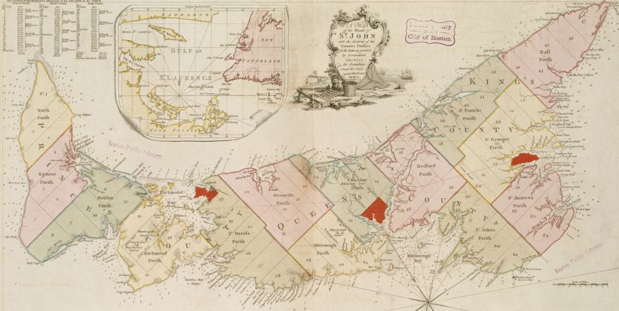
By 1770, Holland moved to Portsmouth, New Hampshire, where he continued to direct surveys of the British North American territories.5 With revolution forthcoming, Holland returned to Britain in 1775 out of fears that he would be targeted by revolutionaries due to his connections to the crown. During his time in London, Holland provided maps from his general survey of the Northern District to be published in JFW Des Barres’ The Atlantic Neptune. After receiving a military commission, Holland returned to North America in 1776. Holland became head of the elite “Guides and Pioneers” along with Charles Blaskowitz and George Sproule. This group was assigned the significant task of producing wartime maps for the British. Holland’s active combat service ended in October 1778, when Quebec’s Governor Frederick Haldimand called upon Holland to resume his surveyal duties. Returning with his family to Quebec, Holland acquired vast amounts of personal landholdings, and was an active participant in the Quebec Legislative Council. However, due to his declining health, Holland was mostly confined to his house overseeing his surveying teams from afar and spending his days completing paperwork.
Growing old and unable to properly fulfill his duties, Holland was forced to step back further. Seeing the elderly Holland, the First Lieutenant Governor of Upper Canada John Graves Simcoe remarked, “Poor Holland … that good and faithful servant of the Crown is worn out in body, tho’ in full possession of his intellect.”6 Most of Holland’s final projects during the 1790s focused on mapping and distributing claims to new townships in Lower Canada. He petitioned for vast amounts of land for himself in the newly established Kingsey Township in Quebec.7 Holland slowly began to delegate his positions to others, and ultimately transferred his duties as Surveyor General to William Vondenvelden in 1801. Shortly after relinquishing his duties, Holland died on December 28, 1801, at Holland House in Quebec.
Banner image credit: detail from a reproduction of an engraving of Samuel Holland, unknown provenance, courtesy Wikimedia Commons.
Bibliography
Brown, Richard H. and Paul E. Cohen. Revolution: Mapping the Road to American Independence, 1755-1783. New York: W.W. Norton and Co., 2015.
Edelson, S. Max. The New Map of Empire: How Britain Imagined America before Independence. Cambridge: Harvard University Press, 2017.
Holland, Samuel (1766-1792), Government of Canada Library and Archives. https://recherche-collection-search.bac-lac.gc.ca/eng/home/record?app=lanpetlowcan&IdNumber=42071&new=-8585561112808915467
Holland, Samuel, and Assoc., 1792-1819, Government of Canada Library and Archives. https://recherche-collection-search.bac-lac.gc.ca/eng/home/record?app=lanpetlowcan&IdNumber=42116&new=-8585561113037997189
Hornsby, Stephen J. and Hope Stege. Surveyors of Empire Samuel Holland, J.W.F. Des Barres, and the Making of the Atlantic Neptune. Montreal: McGill-Queen’s University Press, 2011.
Johnson, Alexander. The First Mapping of America : The General Survey of British North America. London, England: I.B. Tauris, 2019.
Robson, John. Captain Cook’s War and Peace: The Royal Navy Years, 1755-1768. Annapolis: Naval Institute Press, 2009.
Thorpe, Frederick J. “HOLLAND, SAMUEL JOHANNES,” in Dictionary of Canadian Biography, vol. 5, University of Toronto/Université Laval, 2003. http://www.biographi.ca/en/bio/holland_samuel_johannes_5E.html.
Thorpe, Frederick J. “Samuel Holland: From Gunner and Sapper to Surveyor-General, 1755-1764.” Canadian Military History, Vol. 27 (2018), Issue 1, Article 17. https://scholars.wlu.ca/cgi/viewcontent.cgi?article=1920&context=cmh
Thorpe, Frederick J. “Samuel Johannes Holland: The Dutch Grooming of the Canadian Land Surveyor (1729-1755).” Canadian Journal of Netherlandic Studies 30, no. 2 (Fall, 2009):
Footnotes
-
James Wolfe quoted in Stephen J. Hornsby, and Hope Stege, Surveyors of Empire: Samuel Holland, J.W.F. Des Barres, and the Making of the Atlantic Neptune (Montreal: McGill-Queen’s University Press, 2011), 16. ↩
-
“Letter from Samuel Holland to John Graves Simcoe,” January 11, 1792, in John Robson, Captain Cook’s War, and Peace: The Royal Navy Years, 1755-1768 (Annapolis: Naval Institute Press, 2009), 63. ↩
-
James Murray quoted in Alexander Johnson, The First Mapping of America: The General Survey of British North America (London: I.B. Tauris, 2019), 26; For a later correspondence between Holland and Murray see Holland, Samuel (1766-1792), 8, Government of Canada Library and Archives. https://recherche-collection-search.bac-lac.gc.ca/eng/home/record?app=lanpetlowcan&IdNumber=42071&new=-8585561112808915467 ↩
-
Samuel Holland, “A Letter to the Astronomer Royal, from Samuel Holland, Esq. Surveyor General of Lands for the Northern District of America, Containing Some Eclipses of Jupiter’s Satellites, Observed Near Quebec,” Philosophical Transactions (1683-1775) 64 (1774): 172 ↩
-
Holland, “A Letter to the Astronomer Royal,” 175. ↩
-
John Graves Simcoe quoted in Hornsby and Stege, Surveyors of Empire, 208. ↩
-
For details on Holland’s land acquisitions and the establishment of townships in Lower Canada in the 1790s to his death, see Holland, Samuel, and Assoc. (1792-1819), 1-22, Government of Canada Library and Archives. ↩